 Tadley
Dufftown
Newbury
Cremyll
Broadstairs
Arnol
Scotton
Carnforth
Escrick
Portrush
Tidworth
Farnborough
Erith
Honiton
Garvagh
Colne
Westminster
Peterlee
Catshill
Tadley
Dufftown
Newbury
Cremyll
Broadstairs
Arnol
Scotton
Carnforth
Escrick
Portrush
Tidworth
Farnborough
Erith
Honiton
Garvagh
Colne
Westminster
Peterlee
Catshill
Fraserburgh on the map, United Kingdom
Where is located Fraserburgh
Exact location — Fraserburgh, Aberdeenshire, Scotland, United Kingdom, marked on the map with a red marker.
Coordinates
Fraserburgh, United Kingdom coordinates in decimal format: latitude — 57.693352, longitude — -2.007631. When converted to degrees, minutes, seconds Fraserburgh has the following coordinates: 57°41′36.07 north latitude and -2°0′27.47 east longitude.
Population
Fraserburgh, Aberdeenshire, Scotland, United Kingdom, according to our data the population is — 12,249 residents, which is about 0% of the total population of the country (United Kingdom).
Comparison of the population on the graph:
Exact time
Time zone for this location Fraserburgh — UTC +1 Europe/London. Exact time — saturday, 4 april 2024 year, 13 h. 56 minutes.
Sunrise and sunset
Fraserburgh, sunrise and sunset data for a date — saturday 20.04.2024.
| Sunrise | Sunset | Day (duration) |
|---|---|---|
| 05:47 -3 minutes | 20:26 +3 minutes | 14 h. 42 minutes. +6 minutes |
You can control the scale of the map using the auxiliary tools to find out exactly where it is located Fraserburgh. When you change the scale of the map, the width of the ruler also changes (in kilometers and miles).
Nearby cities
The largest cities that are located nearby:
- Edinburgh — 206 km
- Glasgow — 246 km
- Sunderland — 311 km
- Belfast — 425 km
- Preston — 437 km
- Blackburn — 437 km
- Huddersfield — 448 km
- Stavanger
 (Norway) — 463 km
 - Manchester — 466 km
- Rotherham — 473 km
- Sheffield — 478 km
- Liverpool — 478 km
- Bergen (Norway) — 499 km
- Stoke-on-Trent — 519 km
- Telford — 555 km
- Dublin
 (Ireland) — 556 km
 - Leicester — 562 km
- Sutton Coldfield — 567 km
- West Bromwich — 572 km
Distance to neighboring capitals:
- Dublin (Ireland) — 552 km
- Amsterdam
 (Netherlands) — 737 km
 - Brussels
 (Belgium) — 865 km
 - Paris
 (France) — 1024 km
 - Paris (France) — 1024 km
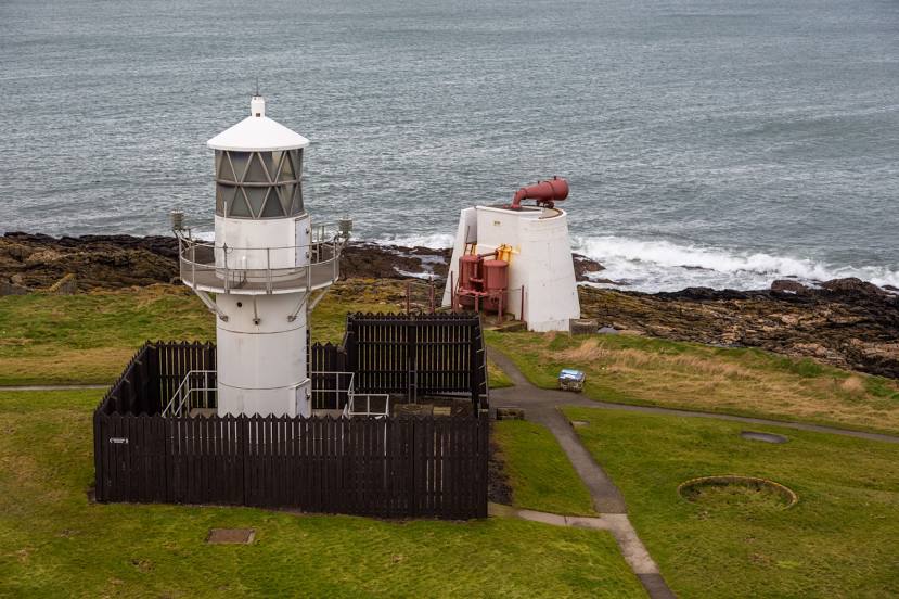
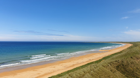
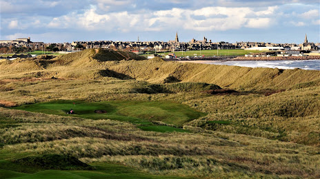
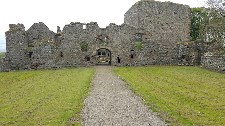
Attractions

Distance to the capital
Distance to the capital (London) is about — 699 km.