 Redhill
Topsham
Shaldon
Ilsington
Llandrillo
Hunstanton
Ballymena
Overstrand
Kinrara
Silloth
Helmsdale
Nelson
Quinton
Sheerness
Stourport-on-Severn
Penshurst
Manchester
Royal Military Academy
Camberley
Redhill
Topsham
Shaldon
Ilsington
Llandrillo
Hunstanton
Ballymena
Overstrand
Kinrara
Silloth
Helmsdale
Nelson
Quinton
Sheerness
Stourport-on-Severn
Penshurst
Manchester
Royal Military Academy
Camberley
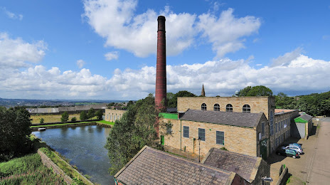
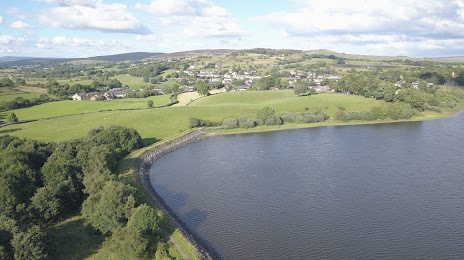
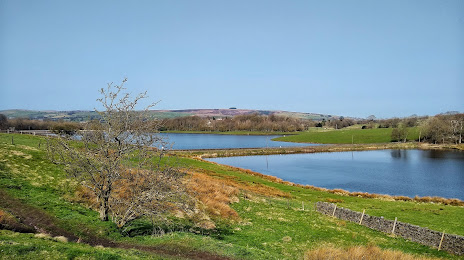
Brierfield on the map, United Kingdom
Where is located Brierfield
Exact location — Brierfield, Lancashire, England, United Kingdom, marked on the map with a red marker.
Coordinates
Brierfield, United Kingdom coordinates in decimal format: latitude — 53.821604, longitude — -2.2367309. When converted to degrees, minutes, seconds Brierfield has the following coordinates: 53°49′17.77 north latitude and -2°14′12.23 east longitude.
Population
Brierfield, Lancashire, England, United Kingdom, according to our data the population is — 10,271 residents, which is about 0% of the total population of the country (United Kingdom).
Comparison of the population on the graph:
Exact time
Time zone for this location Brierfield — UTC +1 Europe/London. Exact time — saturday, 4 april 2024 year, 12 h. 22 minutes.
Sunrise and sunset
Brierfield, sunrise and sunset data for a date — saturday 20.04.2024.
| Sunrise | Sunset | Day (duration) |
|---|---|---|
| 05:59 -2 minutes | 20:16 +2 minutes | 14 h. 18 minutes. +4 minutes |
You can control the scale of the map using the auxiliary tools to find out exactly where it is located Brierfield. When you change the scale of the map, the width of the ruler also changes (in kilometers and miles).
Nearby cities
The largest cities that are located nearby:
- Blackburn — 18 km
- Preston — 31 km
- Huddersfield — 35 km
- Manchester — 38 km
- Liverpool — 68 km
- Sheffield — 70 km
- Rotherham — 72 km
- Stoke-on-Trent — 91 km
- Telford — 127 km
- Sunderland — 132 km
- Sutton Coldfield — 141 km
- West Bromwich — 145 km
- Dudley — 145 km
- Birmingham — 149 km
- Leicester — 150 km
- Coventry — 164 km
- Worcester — 180 km
- Northampton — 197 km
- Cheltenham — 213 km
Distance to neighboring capitals:
- Dublin
 (Ireland) — 271 km
 - Amsterdam
 (Netherlands) — 503 km
 - Brussels
 (Belgium) — 556 km
 - Paris
 (France) — 637 km
 - Paris (France) — 637 km
Attractions

Distance to the capital
Distance to the capital (London) is about — 294 km.