 Betteshanger
Lynton
Amesbury
Marlow
Burford
Chipping Norton
Marlborough
Cairnryan
Lydney
Betteshanger
Lynton
Amesbury
Marlow
Burford
Chipping Norton
Marlborough
Cairnryan
Lydney
Zufari: Ride into Africa! on the map, Epsom, United Kingdom
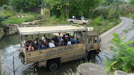
Photo
Where is located Zufari: Ride into Africa!
Zufari: Ride into Africa! — local attraction, which is located at Leatherhead Rd, Chessington KT9 2NE, United Kingdom and belongs to the category — animal park. Average visitor rating for this place — 3.9 (according to 553 ratings, information from open sources and relevant for 2022).
Exact location — Zufari: Ride into Africa!, marked on the map with a red marker.
You can get directions to Zufari: Ride into Africa! on the map from your location.
What else is interesting in Epsom? You can see all the sights if you go to the city page.
Coordinates
Zufari: Ride into Africa!, United Kingdom coordinates in decimal format: latitude — 51.349688675312265, longitude — -0.3189502747809806. When converted to degrees, minutes, seconds Zufari: Ride into Africa! has the following coordinates: 51°20′58.88 north latitude and -0°19′8.22 east longitude.
Nearby cities
The largest cities that are located nearby:
- Sutton — 6 km
- Crawley — 26 km
- Slough — 30 km
- Watford — 36 km
- Reading — 51 km
- Gillingham — 57 km
- Basildon — 58 km
- Luton — 61 km
- Chelmsford — 67 km
- Southend-on-Sea — 71 km
- Eastbourne — 74 km
- Portsmouth — 81 km
- Oxford — 82 km
- Southampton — 92 km
- Cambridge — 100 km
- Swindon — 107 km
- Northampton — 109 km
- Ipswich — 125 km
- Bournemouth — 132 km
Distance to the capital
Distance to the capital (London) is about — 22 km.