 Betteshanger
Lynton
Amesbury
Marlow
Burford
Chipping Norton
Marlborough
Cairnryan
Lydney
Betteshanger
Lynton
Amesbury
Marlow
Burford
Chipping Norton
Marlborough
Cairnryan
Lydney
Tavistock Golf Club on the map, Tavistock, United Kingdom
Photo
Where is located Tavistock Golf Club
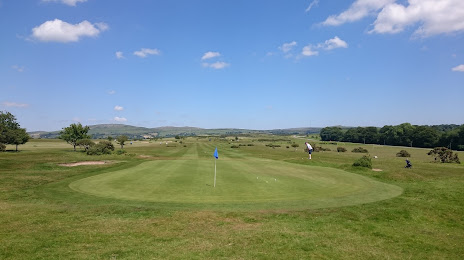
Tavistock Golf Club — local attraction, which is located at Down Rd, Tavistock PL19 9AQ, United Kingdom and belongs to the category — golf club. Average visitor rating for this place — - (according to 26 ratings, information from open sources and relevant for 2022).
Exact location — Tavistock Golf Club, marked on the map with a red marker.
You can get directions to Tavistock Golf Club on the map from your location.
What else is interesting in Tavistock? You can see all the sights if you go to the city page.
Coordinates
Tavistock Golf Club, United Kingdom coordinates in decimal format: latitude — 50.54401458941496, longitude — -4.130107274810386. When converted to degrees, minutes, seconds Tavistock Golf Club has the following coordinates: 50°32′38.45 north latitude and -4°7′48.39 east longitude.
Nearby cities
The largest cities that are located nearby:
- Exeter — 46 km
- Bristol — 146 km
- Bournemouth — 159 km
- Southampton — 195 km
- Swindon — 197 km
- Cheltenham — 205 km
- Portsmouth — 215 km
- Worcester — 223 km
- Oxford — 238 km
- Reading — 240 km
- Brest
 (France) — 240 km
 - Dudley — 257 km
- West Bromwich — 261 km
- Telford — 261 km
- Birmingham — 262 km
- Slough — 266 km
- Coventry — 271 km
- Sutton Coldfield — 272 km
- Crawley — 281 km
Distance to the capital
Distance to the capital (London) is about — 300 km.