
 Pointe-à-la-Croix
Sainte-Irène, Quebec
Marsoui
Hecla
Muskrat Dam
Wunnummin Lake
Sainte-Brigitte-de-Laval
Drayton
Mauricie
Pointe-à-la-Croix
Sainte-Irène, Quebec
Marsoui
Hecla
Muskrat Dam
Wunnummin Lake
Sainte-Brigitte-de-Laval
Drayton
Mauricie
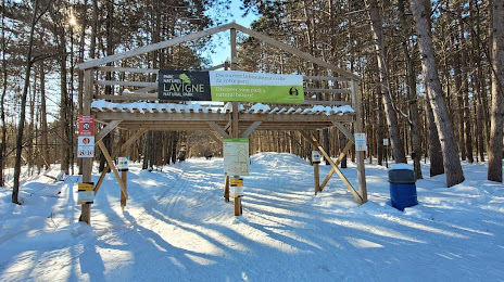
Lavigne Natural Park - South on the map, Clarence-Rockland, Canada
Photo
Where is located Lavigne Natural Park - South
Lavigne Natural Park - South — local attraction, which is located at Cardinal Trail, Clarence-Rockland, ON, Canada and belongs to the category — park. Average visitor rating for this place — 4.8 (according to 37 ratings, information from open sources and relevant for 2022).
Exact location — Lavigne Natural Park - South, marked on the map with a red marker.
You can get directions to Lavigne Natural Park - South on the map from your location.
What else is interesting in Clarence-Rockland? You can see all the sights if you go to the city page.
Coordinates
Lavigne Natural Park - South, Canada coordinates in decimal format: latitude — 45.443020790985024, longitude — -75.18511895374994. When converted to degrees, minutes, seconds Lavigne Natural Park - South has the following coordinates: 45°26′34.87 north latitude and -75°11′6.43 east longitude.
Nearby cities
The largest cities that are located nearby:
- Gatineau — 34 km
- Laval — 121 km
- Montreal — 133 km
- Longueuil — 137 km
- Kingston — 174 km
- Trois-Rivières — 227 km
- Sherbrooke — 264 km
- Syracuse
 (United States) — 285 km
 - Rochester (United States) — 324 km
- Levis — 333 km
- Quebec — 335 km
- Oshawa — 339 km
- Whitby — 344 km
- Barrie — 371 km
- Markham — 374 km
- Richmond Hill — 379 km
- Vaughan — 387 km
- Toronto — 390 km
- Amherst (United States) — 402 km
Distance to the capital
Distance to the capital (Ottawa) is about — 40 km.