 Betteshanger
Lynton
Amesbury
Marlow
Burford
Chipping Norton
Marlborough
Cairnryan
Lydney
Betteshanger
Lynton
Amesbury
Marlow
Burford
Chipping Norton
Marlborough
Cairnryan
Lydney
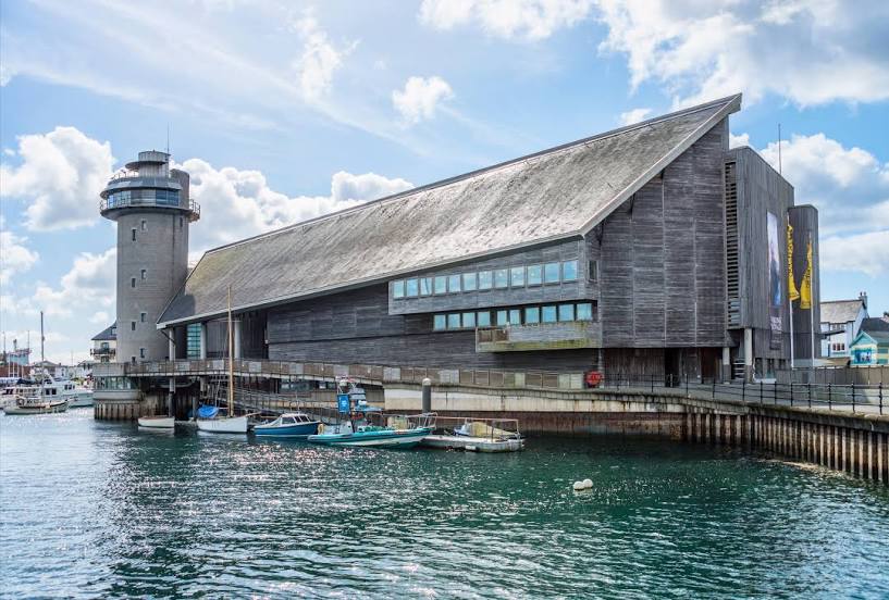
National Maritime Museum Cornwall on the map, Falmouth, United Kingdom
Photo
Where is located National Maritime Museum Cornwall
National Maritime Museum Cornwall — local attraction, which is located at Discovery Quay, Port Pendennis, Falmouth TR11 3QY, United Kingdom and belongs to the category — museum. Average visitor rating for this place — 4.4 (according to 1652 ratings, information from open sources and relevant for 2022).
Exact location — National Maritime Museum Cornwall, marked on the map with a red marker.
You can get directions to National Maritime Museum Cornwall on the map from your location.
What else is interesting in Falmouth? You can see all the sights if you go to the city page.
Coordinates
National Maritime Museum Cornwall, United Kingdom coordinates in decimal format: latitude — 50.150987806045244, longitude — -5.062935074824582. When converted to degrees, minutes, seconds National Maritime Museum Cornwall has the following coordinates: 50°9′3.56 north latitude and -5°3′46.57 east longitude.
Nearby cities
The largest cities that are located nearby:
- Exeter — 124 km
- Brest
 (France) — 199 km
 - Bristol — 223 km
- Bournemouth — 232 km
- Southampton — 269 km
- Swindon — 274 km
- Cheltenham — 281 km
- Portsmouth — 288 km
- Worcester — 297 km
- Cork
 (Ireland) — 303 km
 - Oxford — 315 km
- Reading — 316 km
- Dudley — 329 km
- Telford — 330 km
- West Bromwich — 333 km
- Birmingham — 335 km
- Rennes (France) — 336 km
- Slough — 342 km
- Sutton Coldfield — 345 km
Distance to the capital
Distance to the capital (London) is about — 378 km.