 Betteshanger
Lynton
Amesbury
Marlow
Burford
Chipping Norton
Marlborough
Cairnryan
Lydney
Betteshanger
Lynton
Amesbury
Marlow
Burford
Chipping Norton
Marlborough
Cairnryan
Lydney
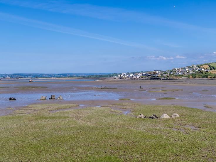
Northam Burrows Country Park on the map, Bideford, United Kingdom
Photo
Where is located Northam Burrows Country Park
Northam Burrows Country Park — local attraction, which is located at The Burrows Centre, Sandymere Rd, Northam, Bideford EX39 1XS, United Kingdom and belongs to the category — country park. Average visitor rating for this place — 4.7 (according to 827 ratings, information from open sources and relevant for 2022).
Exact location — Northam Burrows Country Park, marked on the map with a red marker.
You can get directions to Northam Burrows Country Park on the map from your location.
What else is interesting in Bideford? You can see all the sights if you go to the city page.
Coordinates
Northam Burrows Country Park, United Kingdom coordinates in decimal format: latitude — 51.048739027592035, longitude — -4.226301719435429. When converted to degrees, minutes, seconds Northam Burrows Country Park has the following coordinates: 51°2′55.46 north latitude and -4°13′34.69 east longitude.
Nearby cities
The largest cities that are located nearby:
- Exeter — 57 km
- Bristol — 122 km
- Bournemouth — 166 km
- Cheltenham — 175 km
- Swindon — 177 km
- Worcester — 187 km
- Southampton — 196 km
- Oxford — 218 km
- Telford — 218 km
- Dudley — 219 km
- Portsmouth — 219 km
- West Bromwich — 223 km
- Birmingham — 225 km
- Reading — 228 km
- Sutton Coldfield — 235 km
- Coventry — 238 km
- Slough — 254 km
- Stoke-on-Trent — 258 km
- Northampton — 261 km
Distance to the capital
Distance to the capital (London) is about — 290 km.