 Betteshanger
Lynton
Amesbury
Marlow
Burford
Chipping Norton
Marlborough
Cairnryan
Lydney
Betteshanger
Lynton
Amesbury
Marlow
Burford
Chipping Norton
Marlborough
Cairnryan
Lydney
Antrim Castle on the map, Antrim, United Kingdom
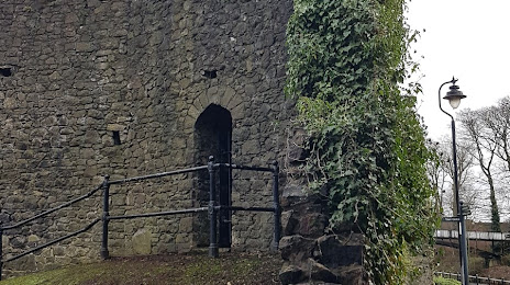
Photo
Where is located Antrim Castle
Antrim Castle — local attraction, which is located at 50-52 High St, Antrim BT41 4DS, United Kingdom and belongs to the category — castle. Average visitor rating for this place — 4.6 (according to 13 ratings, information from open sources and relevant for 2022).
Exact location — Antrim Castle, marked on the map with a red marker.
You can get directions to Antrim Castle on the map from your location.
What else is interesting in Antrim? You can see all the sights if you go to the city page.
Coordinates
Antrim Castle, United Kingdom coordinates in decimal format: latitude — 54.721912998350604, longitude — -6.230897374654405. When converted to degrees, minutes, seconds Antrim Castle has the following coordinates: 54°43′18.89 north latitude and -6°13′51.23 east longitude.
Nearby cities
The largest cities that are located nearby:
- Belfast — 22 km
- Dublin
 (Ireland) — 151 km
 - Glasgow — 175 km
- Edinburgh — 231 km
- Preston — 252 km
- Liverpool — 257 km
- Blackburn — 266 km
- Manchester — 295 km
- Sunderland — 307 km
- Huddersfield — 313 km
- Stoke-on-Trent — 328 km
- Telford — 338 km
- Sheffield — 346 km
- Cork (Ireland) — 349 km
- Rotherham — 349 km
- Dudley — 370 km
- West Bromwich — 374 km
- Sutton Coldfield — 378 km
- Birmingham — 381 km
Distance to the capital
Distance to the capital (London) is about — 542 km.