
 Pithoro
Kandhra
Sultan Kot
Rahimabad
Mithiani
New Jatoi
Ratanabad
Bhaledino Kaka
Arija
Pithoro
Kandhra
Sultan Kot
Rahimabad
Mithiani
New Jatoi
Ratanabad
Bhaledino Kaka
Arija
Darbar mehl on the map, Bahawalpur, Pakistan
Photo
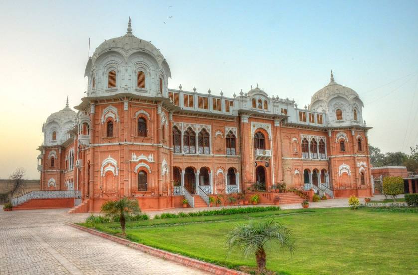
Where is located Darbar mehl
Darbar mehl — local attraction, which is located at Darbar Mahal Road، Bahawalpur Palaces, Bahawalpur, Punjab 63100, Pakistan and belongs to the category — historical place museum. Average visitor rating for this place — 4.6 (according to 9 ratings, information from open sources and relevant for 2022).
Exact location — Darbar mehl, marked on the map with a red marker.
You can get directions to Darbar mehl on the map from your location.
What else is interesting in Bahawalpur? You can see all the sights if you go to the city page.
Coordinates
Darbar mehl, Pakistan coordinates in decimal format: latitude — 29.396619318738033, longitude — 71.69972942464943. When converted to degrees, minutes, seconds Darbar mehl has the following coordinates: 29°23′47.83 north latitude and 71°41′59.03 east longitude.
Nearby cities
The largest cities that are located nearby:
- Muzaffargarh — 89 km
- Multan — 91 km
- Khanewal — 103 km
- Chishtian Mandi — 121 km
- Dera Ghāzi Khān — 122 km
- Burewala — 127 km
- Khanpur — 130 km
- Kot Addu — 136 km
- Bahawalnagar — 165 km
- Kamalia — 173 km
- Sadiqabad — 193 km
- Pākpattan — 194 km
- Sahiwal — 195 km
- Gojra — 216 km
- Bikaner
 (India) — 220 km
 - Okāra — 229 km
- Faisalabad — 260 km
- Jaranwala — 270 km
- Dera Ismail Khan — 280 km
Distance to the capital
Distance to the capital (Islamabad) is about — 500 km.