 Betteshanger
Lynton
Amesbury
Marlow
Burford
Chipping Norton
Marlborough
Cairnryan
Lydney
Betteshanger
Lynton
Amesbury
Marlow
Burford
Chipping Norton
Marlborough
Cairnryan
Lydney
Craig-Y-Don Park on the map, Llandudno, United Kingdom
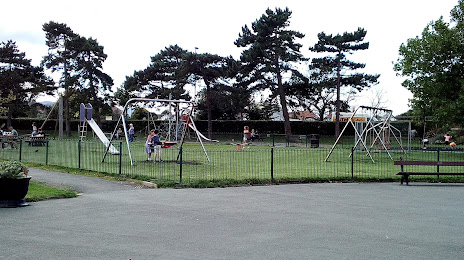
Photo
Where is located Craig-Y-Don Park
Craig-Y-Don Park — local attraction, which is located at Queen's Rd, Llandudno LL30 1TY, United Kingdom and belongs to the category — park. Average visitor rating for this place — 4.5 (according to 322 ratings, information from open sources and relevant for 2022).
Exact location — Craig-Y-Don Park, marked on the map with a red marker.
You can get directions to Craig-Y-Don Park on the map from your location.
What else is interesting in Llandudno? You can see all the sights if you go to the city page.
Coordinates
Craig-Y-Don Park, United Kingdom coordinates in decimal format: latitude — 53.31823138456216, longitude — -3.8097962247077577. When converted to degrees, minutes, seconds Craig-Y-Don Park has the following coordinates: 53°19′5.63 north latitude and -3°48′35.27 east longitude.
Nearby cities
The largest cities that are located nearby:
- Liverpool — 56 km
- Preston — 88 km
- Blackburn — 99 km
- Manchester — 106 km
- Stoke-on-Trent — 115 km
- Telford — 117 km
- Huddersfield — 139 km
- Dudley — 148 km
- West Bromwich — 152 km
- Sheffield — 156 km
- Sutton Coldfield — 158 km
- Birmingham — 160 km
- Dublin
 (Ireland) — 161 km
 - Rotherham — 163 km
- Worcester — 166 km
- Coventry — 186 km
- Belfast — 195 km
- Leicester — 196 km
- Cheltenham — 198 km
Distance to the capital
Distance to the capital (London) is about — 321 km.