 Betteshanger
Lynton
Amesbury
Marlow
Burford
Chipping Norton
Marlborough
Cairnryan
Lydney
Betteshanger
Lynton
Amesbury
Marlow
Burford
Chipping Norton
Marlborough
Cairnryan
Lydney
Hull & East Riding Museum on the map, Ilkeston, United Kingdom
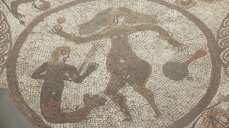
Photo
Where is located Hull & East Riding Museum
Hull & East Riding Museum — local attraction, which is located at 36 High St, Hull HU1 1NQ, United Kingdom and belongs to the category — history museum. Average visitor rating for this place — 4.6 (according to 416 ratings, information from open sources and relevant for 2022).
Exact location — Hull & East Riding Museum, marked on the map with a red marker.
You can get directions to Hull & East Riding Museum on the map from your location.
What else is interesting in Ilkeston? You can see all the sights if you go to the city page.
Coordinates
Hull & East Riding Museum, United Kingdom coordinates in decimal format: latitude — 53.35975653264942, longitude — -0.9358230136965959. When converted to degrees, minutes, seconds Hull & East Riding Museum has the following coordinates: 53°21′35.12 north latitude and -0°56′8.96 east longitude.
Nearby cities
The largest cities that are located nearby:
- Leicester — 39 km
- Sheffield — 47 km
- Rotherham — 51 km
- Sutton Coldfield — 56 km
- Stoke-on-Trent — 58 km
- Coventry — 64 km
- Birmingham — 66 km
- West Bromwich — 68 km
- Dudley — 73 km
- Huddersfield — 81 km
- Telford — 83 km
- Manchester — 84 km
- Northampton — 85 km
- Worcester — 106 km
- Blackburn — 116 km
- Liverpool — 121 km
- Preston — 127 km
- Cambridge — 129 km
- Cheltenham — 130 km
Distance to the capital
Distance to the capital (London) is about — 213 km.