
 Warner Robins
Wantagh
Bethel
Misty Hill Farm
United States
Wakonda Beach (R33) Airport
Wilmington
Poland
Miami International Airport
Warner Robins
Wantagh
Bethel
Misty Hill Farm
United States
Wakonda Beach (R33) Airport
Wilmington
Poland
Miami International Airport
Sandy Bottom Nature Park on the map, Hampton, United States
Photo
Where is located Sandy Bottom Nature Park
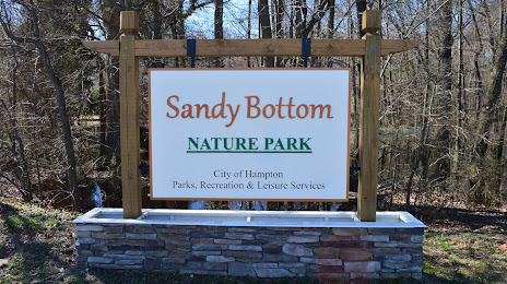
Sandy Bottom Nature Park — local attraction, which is located at 1255 Big Bethel Rd, Hampton, VA 23666, United States and belongs to the category — city park. Average visitor rating for this place — 4.6 (according to 1894 ratings, information from open sources and relevant for 2022).
Exact location — Sandy Bottom Nature Park, marked on the map with a red marker.
You can get directions to Sandy Bottom Nature Park on the map from your location.
What else is interesting in Hampton? You can see all the sights if you go to the city page.
Coordinates
Sandy Bottom Nature Park, United States coordinates in decimal format: latitude — 37.063183854038066, longitude — -76.43222067515322. When converted to degrees, minutes, seconds Sandy Bottom Nature Park has the following coordinates: 37°3′47.46 north latitude and -76°25′55.99 east longitude.
Nearby cities
The largest cities that are located nearby:
- Norfolk — 20 km
- Chesapeake — 29 km
- Virginia Beach — 38 km
- Richmond — 111 km
- Alexandria — 205 km
- Raleigh — 248 km
- Baltimore — 251 km
- Durham — 256 km
- Cary — 258 km
- Fayetteville — 317 km
- Greensboro — 326 km
- Philadelphia — 338 km
- Winston-Salem — 363 km
- Toms River — 371 km
- Allentown — 402 km
- Edison — 419 km
- Elizabeth — 440 km
- Newark — 448 km
- Brooklyn — 451 km
Distance to the capital
Distance to the capital (Washington) is about — 212 km.