
 Warner Robins
Wantagh
Bethel
Misty Hill Farm
United States
Wakonda Beach (R33) Airport
Wilmington
Poland
Miami International Airport
Warner Robins
Wantagh
Bethel
Misty Hill Farm
United States
Wakonda Beach (R33) Airport
Wilmington
Poland
Miami International Airport
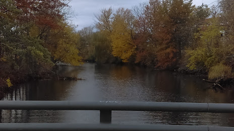
Woonasquatucket River Watershed Council on the map, Providence, United States
Photo
Where is located Woonasquatucket River Watershed Council
Woonasquatucket River Watershed Council — local attraction, which is located at 45 Eagle St, Providence, RI 02909, United States and belongs to the category — non-profit organization. Average visitor rating for this place — 4.6 (according to 7 ratings, information from open sources and relevant for 2022).
Exact location — Woonasquatucket River Watershed Council, marked on the map with a red marker.
You can get directions to Woonasquatucket River Watershed Council on the map from your location.
What else is interesting in Providence? You can see all the sights if you go to the city page.
Coordinates
Woonasquatucket River Watershed Council, United States coordinates in decimal format: latitude — 41.8256451022403, longitude — -71.43675437501118. When converted to degrees, minutes, seconds Woonasquatucket River Watershed Council has the following coordinates: 41°49′32.32 north latitude and -71°26′12.32 east longitude.
Nearby cities
The largest cities that are located nearby:
- Worcester — 58 km
- Cambridge — 66 km
- Boston — 66 km
- Lowell — 90 km
- Springfield — 101 km
- Hartford — 105 km
- Amherst — 105 km
- Manchester — 130 km
- New Haven — 138 km
- Waterbury — 139 km
- Bridgeport — 164 km
- Stamford — 197 km
- Yonkers — 230 km
- New York — 250 km
- Brooklyn — 250 km
- Paterson — 251 km
- Newark — 261 km
- Elizabeth — 267 km
- Edison — 290 km
Distance to the capital
Distance to the capital (Washington) is about — 575 km.