
 Warner Robins
Wantagh
Bethel
Misty Hill Farm
United States
Wakonda Beach (R33) Airport
Wilmington
Poland
Miami International Airport
Warner Robins
Wantagh
Bethel
Misty Hill Farm
United States
Wakonda Beach (R33) Airport
Wilmington
Poland
Miami International Airport
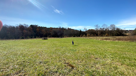
Merritt's Pasture on the map, Chapel Hill, United States
Photo
Where is located Merritt's Pasture
Merritt's Pasture — local attraction, which is located at Morgan Creek Trail, Chapel Hill, NC 27517, United States and belongs to the category — park. Average visitor rating for this place — 4.7 (according to 70 ratings, information from open sources and relevant for 2022).
Exact location — Merritt's Pasture, marked on the map with a red marker.
You can get directions to Merritt's Pasture on the map from your location.
What else is interesting in Chapel Hill? You can see all the sights if you go to the city page.
Coordinates
Merritt's Pasture, United States coordinates in decimal format: latitude — 35.89172056744776, longitude — -79.05582257518603. When converted to degrees, minutes, seconds Merritt's Pasture has the following coordinates: 35°53′30.19 north latitude and -79°3′20.96 east longitude.
Nearby cities
The largest cities that are located nearby:
- Durham — 17 km
- Cary — 28 km
- Raleigh — 40 km
- Greensboro — 68 km
- Fayetteville — 96 km
- Winston-Salem — 108 km
- Charlotte — 178 km
- Richmond — 229 km
- Chesapeake — 263 km
- Norfolk — 266 km
- Hampton — 269 km
- Columbia — 279 km
- Virginia Beach — 291 km
- Charleston — 356 km
- Alexandria — 364 km
- Baltimore — 428 km
- Knoxville — 435 km
- Savannah — 465 km
- Pittsburgh — 507 km
Distance to the capital
Distance to the capital (Washington) is about — 380 km.