
 Warner Robins
Wantagh
Bethel
Misty Hill Farm
United States
Wakonda Beach (R33) Airport
Wilmington
Poland
Miami International Airport
Warner Robins
Wantagh
Bethel
Misty Hill Farm
United States
Wakonda Beach (R33) Airport
Wilmington
Poland
Miami International Airport
Reid Merrill Park on the map, Boise, United States
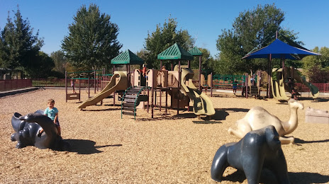
Photo
Where is located Reid Merrill Park
Reid Merrill Park — local attraction, which is located at 637 E Shore Dr, Eagle, ID 83616, United States and belongs to the category — park. Average visitor rating for this place — 4.7 (according to 581 rating, information from open sources and relevant for 2022).
Exact location — Reid Merrill Park, marked on the map with a red marker.
You can get directions to Reid Merrill Park on the map from your location.
What else is interesting in Boise? You can see all the sights if you go to the city page.
Coordinates
Reid Merrill Park, United States coordinates in decimal format: latitude — 43.68769336728533, longitude — -116.3466454749517. When converted to degrees, minutes, seconds Reid Merrill Park has the following coordinates: 43°41′15.7 north latitude and -116°20′47.92 east longitude.
Nearby cities
The largest cities that are located nearby:
- Spokane — 456 km
- West Valley City — 479 km
- Salt Lake City — 481 km
- West Jordan — 489 km
- Provo — 537 km
- Portland — 543 km
- Vancouver — 546 km
- Reno — 546 km
- Eugene — 548 km
- Salem — 553 km
- Tacoma — 616 km
- Bellevue — 628 km
- Seattle — 634 km
- Roseville — 693 km
- Sacramento — 720 km
- Kelowna
 (Canada) — 731 km
 - Abbotsford (Canada) — 747 km
- Victoria (Canada) — 747 km
- Stockton — 766 km
Distance to the capital
Distance to the capital (Washington) is about — 3296 km.