
 Warner Robins
Wantagh
Bethel
Misty Hill Farm
United States
Wakonda Beach (R33) Airport
Wilmington
Poland
Miami International Airport
Warner Robins
Wantagh
Bethel
Misty Hill Farm
United States
Wakonda Beach (R33) Airport
Wilmington
Poland
Miami International Airport
BRANDY STATION FOUNDATION on the map, Culpeper, United States
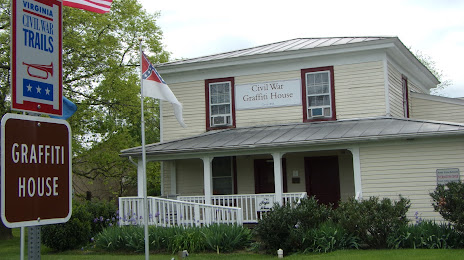
Photo
Where is located BRANDY STATION FOUNDATION
BRANDY STATION FOUNDATION — local attraction, which is located at 19484 Brandy Rd, Brandy Station, VA 22714, United States and belongs to the category — history museum. Average visitor rating for this place — 5.0 (according to 2 ratings, information from open sources and relevant for 2022).
Exact location — BRANDY STATION FOUNDATION, marked on the map with a red marker.
You can get directions to BRANDY STATION FOUNDATION on the map from your location.
What else is interesting in Culpeper? You can see all the sights if you go to the city page.
Coordinates
BRANDY STATION FOUNDATION, United States coordinates in decimal format: latitude — 38.50247919680881, longitude — -77.8908363751119. When converted to degrees, minutes, seconds BRANDY STATION FOUNDATION has the following coordinates: 38°30′8.93 north latitude and -77°53′27.01 east longitude.
Nearby cities
The largest cities that are located nearby:
- Alexandria — 90 km
- Richmond — 114 km
- Baltimore — 149 km
- Hampton — 216 km
- Norfolk — 235 km
- Chesapeake — 242 km
- Virginia Beach — 253 km
- Pittsburgh — 275 km
- Durham — 286 km
- Philadelphia — 290 km
- Raleigh — 303 km
- Cary — 305 km
- Greensboro — 310 km
- Allentown — 316 km
- Winston-Salem — 330 km
- Toms River — 361 km
- Edison — 377 km
- Fayetteville — 386 km
- Elizabeth — 399 km
Distance to the capital
Distance to the capital (Washington) is about — 87 km.