
 Warner Robins
Wantagh
Bethel
Misty Hill Farm
United States
Wakonda Beach (R33) Airport
Wilmington
Poland
Miami International Airport
Warner Robins
Wantagh
Bethel
Misty Hill Farm
United States
Wakonda Beach (R33) Airport
Wilmington
Poland
Miami International Airport
Aeraland Recreational Area on the map, Fostoria, United States
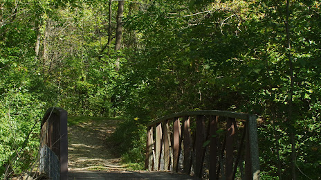
Photo
Where is located Aeraland Recreational Area
Aeraland Recreational Area — local attraction, which is located at 1220 Township Rd 243, Fostoria, OH 44830, United States and belongs to the category — park. Average visitor rating for this place — 4.4 (according to 5 ratings, information from open sources and relevant for 2022).
Exact location — Aeraland Recreational Area, marked on the map with a red marker.
You can get directions to Aeraland Recreational Area on the map from your location.
What else is interesting in Fostoria? You can see all the sights if you go to the city page.
Coordinates
Aeraland Recreational Area, United States coordinates in decimal format: latitude — 41.149063024626976, longitude — -83.51065707503214. When converted to degrees, minutes, seconds Aeraland Recreational Area has the following coordinates: 41°8′56.63 north latitude and -83°30′38.37 east longitude.
Nearby cities
The largest cities that are located nearby:
- Toledo — 57 km
- Ann Arbor — 127 km
- Windsor
 (Canada) — 132 km
 - Detroit — 133 km
- Columbus — 137 km
- Springfield — 140 km
- Fort Wayne — 144 km
- Cleveland — 148 km
- Warren — 154 km
- Akron — 158 km
- Sterling Heights — 160 km
- Aurora — 173 km
- Lansing — 197 km
- Flint — 206 km
- South Bend — 241 km
- Cincinnati — 246 km
- London (Canada) — 268 km
- Grand Rapids — 270 km
- Indianapolis — 279 km
Distance to the capital
Distance to the capital (Washington) is about — 605 km.