
 Warner Robins
Wantagh
Bethel
Misty Hill Farm
United States
Wakonda Beach (R33) Airport
Wilmington
Poland
Miami International Airport
Warner Robins
Wantagh
Bethel
Misty Hill Farm
United States
Wakonda Beach (R33) Airport
Wilmington
Poland
Miami International Airport
Kansas City Automotive Museum on the map, Lenexa, United States
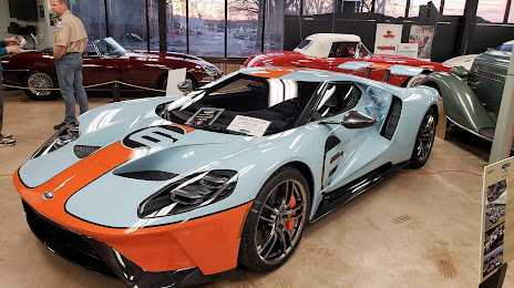
Photo
Where is located Kansas City Automotive Museum
Kansas City Automotive Museum — local attraction, which is located at 15095 W 116th St, Olathe, KS 66062, United States and belongs to the category — museum. Average visitor rating for this place — 4.7 (according to 227 ratings, information from open sources and relevant for 2022).
Exact location — Kansas City Automotive Museum, marked on the map with a red marker.
You can get directions to Kansas City Automotive Museum on the map from your location.
What else is interesting in Lenexa? You can see all the sights if you go to the city page.
Coordinates
Kansas City Automotive Museum, United States coordinates in decimal format: latitude — 38.91810481576592, longitude — -94.76059307509962. When converted to degrees, minutes, seconds Kansas City Automotive Museum has the following coordinates: 38°55′5.18 north latitude and -94°45′38.14 east longitude.
Nearby cities
The largest cities that are located nearby:
- Overland Park — 6 km
- Olathe — 11 km
- Kansas City — 21 km
- North Kansas City — 25 km
- Independence — 31 km
- Topeka — 83 km
- Springfield — 231 km
- Lincoln — 264 km
- Wichita — 267 km
- Omaha — 275 km
- Des Moines — 307 km
- Tulsa — 329 km
- Saint Louis — 393 km
- Oklahoma City — 460 km
- Peoria — 472 km
- Norman — 479 km
- Little Rock — 515 km
- Sioux Falls — 532 km
- Rockford — 589 km
Distance to the capital
Distance to the capital (Washington) is about — 1531 km.