
 Warner Robins
Wantagh
Bethel
Misty Hill Farm
United States
Wakonda Beach (R33) Airport
Wilmington
Poland
Miami International Airport
Warner Robins
Wantagh
Bethel
Misty Hill Farm
United States
Wakonda Beach (R33) Airport
Wilmington
Poland
Miami International Airport
McDowell Sonoran Preserve on the map, Scottsdale, United States
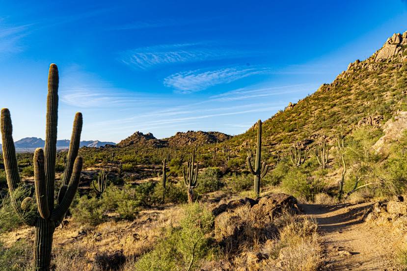
Photo
Where is located McDowell Sonoran Preserve
McDowell Sonoran Preserve — local attraction, which is located at 18333 N Thompson Peak Pkwy, Scottsdale, AZ 85260, United States and belongs to the category — park. Average visitor rating for this place — 4.8 (according to 342 ratings, information from open sources and relevant for 2022).
Exact location — McDowell Sonoran Preserve, marked on the map with a red marker.
You can get directions to McDowell Sonoran Preserve on the map from your location.
What else is interesting in Scottsdale? You can see all the sights if you go to the city page.
Coordinates
McDowell Sonoran Preserve, United States coordinates in decimal format: latitude — 33.658299928077675, longitude — -111.84360562737766. When converted to degrees, minutes, seconds McDowell Sonoran Preserve has the following coordinates: 33°39′29.88 north latitude and -111°50′36.98 east longitude.
Nearby cities
The largest cities that are located nearby:
- Tempe — 8 km
- Mesa — 12 km
- Phoenix — 15 km
- Gilbert — 20 km
- Chandler — 22 km
- Glendale — 24 km
- Peoria — 30 km
- Tucson — 169 km
- Nogales — 256 km
- San Luis Río Colorado
 (Mexico) — 289 km
 - Mexicali (Mexico) — 342 km
- Henderson — 392 km
- Las Vegas — 412 km
- North Las Vegas — 413 km
- Spring Valley — 414 km
- Ensenada (Mexico) — 475 km
- Escondido — 480 km
- Tijuana (Mexico) — 489 km
- Moreno Valley — 489 km
Distance to the capital
Distance to the capital (Washington) is about — 3155 km.