
 Warner Robins
Wantagh
Bethel
Misty Hill Farm
United States
Wakonda Beach (R33) Airport
Wilmington
Poland
Miami International Airport
Warner Robins
Wantagh
Bethel
Misty Hill Farm
United States
Wakonda Beach (R33) Airport
Wilmington
Poland
Miami International Airport
Hopeton Earthworks National Historical Park on the map, Chillicothe, United States
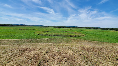
Photo
Where is located Hopeton Earthworks National Historical Park
Hopeton Earthworks National Historical Park — local attraction, which is located at 1138-1286 Hopetown Rd, Chillicothe, OH 45601, United States and belongs to the category — park. Average visitor rating for this place — 4.3 (according to 45 ratings, information from open sources and relevant for 2022).
Exact location — Hopeton Earthworks National Historical Park, marked on the map with a red marker.
You can get directions to Hopeton Earthworks National Historical Park on the map from your location.
What else is interesting in Chillicothe? You can see all the sights if you go to the city page.
Coordinates
Hopeton Earthworks National Historical Park, United States coordinates in decimal format: latitude — 39.37917806098258, longitude — -82.98108177508594. When converted to degrees, minutes, seconds Hopeton Earthworks National Historical Park has the following coordinates: 39°22′45.04 north latitude and -82°58′51.89 east longitude.
Nearby cities
The largest cities that are located nearby:
- Columbus — 69 km
- Springfield — 96 km
- Cincinnati — 134 km
- Akron — 229 km
- Aurora — 258 km
- Toledo — 262 km
- Cleveland — 262 km
- Fort Wayne — 264 km
- Louisville — 269 km
- Indianapolis — 274 km
- Pittsburgh — 280 km
- Windsor
 (Canada) — 330 km
 - Detroit — 332 km
- Ann Arbor — 332 km
- Warren — 352 km
- Sterling Heights — 359 km
- South Bend — 374 km
- Knoxville — 382 km
- Lansing — 397 km
Distance to the capital
Distance to the capital (Washington) is about — 515 km.