
 Warner Robins
Wantagh
Bethel
Misty Hill Farm
United States
Wakonda Beach (R33) Airport
Wilmington
Poland
Miami International Airport
Warner Robins
Wantagh
Bethel
Misty Hill Farm
United States
Wakonda Beach (R33) Airport
Wilmington
Poland
Miami International Airport
Fort Abraham Lincoln State Park on the map, Bismarck, United States
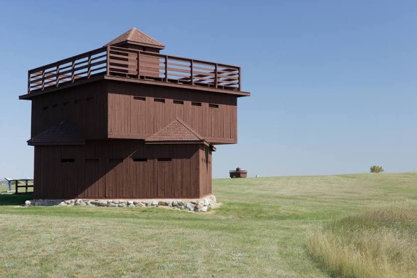
Photo
Where is located Fort Abraham Lincoln State Park
Fort Abraham Lincoln State Park — local attraction, which is located at 4480 Fort Lincoln Rd, Mandan, ND 58554, United States and belongs to the category — state park. Average visitor rating for this place — 4.7 (according to 656 ratings, information from open sources and relevant for 2022).
Exact location — Fort Abraham Lincoln State Park, marked on the map with a red marker.
You can get directions to Fort Abraham Lincoln State Park on the map from your location.
What else is interesting in Bismarck? You can see all the sights if you go to the city page.
Coordinates
Fort Abraham Lincoln State Park, United States coordinates in decimal format: latitude — 46.76602510851363, longitude — -100.84789907484904. When converted to degrees, minutes, seconds Fort Abraham Lincoln State Park has the following coordinates: 46°45′57.69 north latitude and -100°50′52.44 east longitude.
Nearby cities
The largest cities that are located nearby:
- Winnipeg
 (Canada) — 429 km
 - Regina (Canada) — 485 km
- Sioux Falls — 485 km
- Minneapolis — 622 km
- Saint Paul — 636 km
- Saskatoon (Canada) — 711 km
- Omaha — 732 km
- Lincoln — 745 km
- Fort Collins — 777 km
- Des Moines — 827 km
- Thornton — 846 km
- Westminster — 851 km
- Aurora — 855 km
- Arvada — 856 km
- Denver — 859 km
- Lakewood — 866 km
- Colorado Springs — 948 km
- Topeka — 962 km
- North Kansas City — 1001 km
Distance to the capital
Distance to the capital (Washington) is about — 2119 km.