
 Warner Robins
Wantagh
Bethel
Misty Hill Farm
United States
Wakonda Beach (R33) Airport
Wilmington
Poland
Miami International Airport
Warner Robins
Wantagh
Bethel
Misty Hill Farm
United States
Wakonda Beach (R33) Airport
Wilmington
Poland
Miami International Airport
Picnic Island Park on the map, Tampa, United States
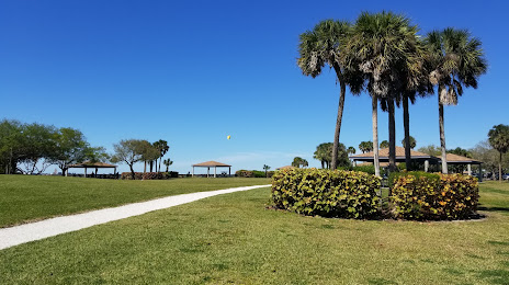
Photo
Where is located Picnic Island Park
Picnic Island Park — local attraction, which is located at 7404 Picnic Island Blvd, Tampa, FL 33616, United States and belongs to the category — city park. Average visitor rating for this place — 4.7 (according to 281 rating, information from open sources and relevant for 2022).
Exact location — Picnic Island Park, marked on the map with a red marker.
You can get directions to Picnic Island Park on the map from your location.
What else is interesting in Tampa? You can see all the sights if you go to the city page.
Coordinates
Picnic Island Park, United States coordinates in decimal format: latitude — 27.853484358318553, longitude — -82.55281240552854. When converted to degrees, minutes, seconds Picnic Island Park has the following coordinates: 27°51′12.54 north latitude and -82°33′10.12 east longitude.
Nearby cities
The largest cities that are located nearby:
- Brandon — 17 km
- Saint Petersburg — 27 km
- Clearwater — 34 km
- Orlando — 123 km
- Cape Coral — 161 km
- Gainesville — 188 km
- Port Saint Lucie — 219 km
- Jacksonville — 274 km
- Coral Springs — 285 km
- Pembroke Pines — 304 km
- Miramar — 305 km
- Fort Lauderdale — 306 km
- Hollywood — 314 km
- Hialeah — 317 km
- Tallahassee — 325 km
- Miami — 331 km
- Savannah — 474 km
- Havana
 (Cuba) — 530 km
 - Matanzas (Cuba) — 552 km
Distance to the capital
Distance to the capital (Washington) is about — 1331 km.