
 Warner Robins
Wantagh
Bethel
Misty Hill Farm
United States
Wakonda Beach (R33) Airport
Wilmington
Poland
Miami International Airport
Warner Robins
Wantagh
Bethel
Misty Hill Farm
United States
Wakonda Beach (R33) Airport
Wilmington
Poland
Miami International Airport
Pawtucket Falls on the map, Lowell, United States
Photo
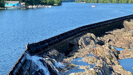
Where is located Pawtucket Falls
Pawtucket Falls — local attraction, which is located at no data and belongs to the category — -. Average visitor rating for this place — 4.9 (according to 12 ratings, information from open sources and relevant for 2022).
Exact location — Pawtucket Falls, marked on the map with a red marker.
You can get directions to Pawtucket Falls on the map from your location.
What else is interesting in Lowell? You can see all the sights if you go to the city page.
Coordinates
Pawtucket Falls, United States coordinates in decimal format: latitude — 42.651194042382784, longitude — -71.32613181057629. When converted to degrees, minutes, seconds Pawtucket Falls has the following coordinates: 42°39′4.3 north latitude and -71°19′34.07 east longitude.
Nearby cities
The largest cities that are located nearby:
- Cambridge — 33 km
- Boston — 37 km
- Manchester — 42 km
- Worcester — 57 km
- Providence — 90 km
- Amherst — 102 km
- Springfield — 120 km
- Hartford — 148 km
- Waterbury — 186 km
- New Haven — 198 km
- Bridgeport — 224 km
- Stamford — 255 km
- Yonkers — 286 km
- Paterson — 305 km
- Sherbrooke
 (Canada) — 309 km
 - New York — 310 km
- Brooklyn — 310 km
- Newark — 318 km
- Elizabeth — 326 km
Distance to the capital
Distance to the capital (Washington) is about — 636 km.