
 Warner Robins
Wantagh
Bethel
Misty Hill Farm
United States
Wakonda Beach (R33) Airport
Wilmington
Poland
Miami International Airport
Warner Robins
Wantagh
Bethel
Misty Hill Farm
United States
Wakonda Beach (R33) Airport
Wilmington
Poland
Miami International Airport
Old Waynesborough Park on the map, Goldsboro, United States
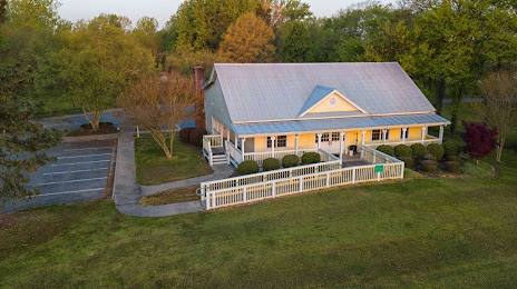
Photo
Where is located Old Waynesborough Park
Old Waynesborough Park — local attraction, which is located at 801 U.S. 117 Bypass South, Goldsboro, NC 27530, United States and belongs to the category — park. Average visitor rating for this place — 4.5 (according to 238 ratings, information from open sources and relevant for 2022).
Exact location — Old Waynesborough Park, marked on the map with a red marker.
You can get directions to Old Waynesborough Park on the map from your location.
What else is interesting in Goldsboro? You can see all the sights if you go to the city page.
Coordinates
Old Waynesborough Park, United States coordinates in decimal format: latitude — 35.37484401382552, longitude — -78.01283647520013. When converted to degrees, minutes, seconds Old Waynesborough Park has the following coordinates: 35°22′29.44 north latitude and -78°0′46.21 east longitude.
Nearby cities
The largest cities that are located nearby:
- Raleigh — 72 km
- Cary — 84 km
- Fayetteville — 88 km
- Durham — 105 km
- Greensboro — 178 km
- Chesapeake — 215 km
- Winston-Salem — 216 km
- Norfolk — 222 km
- Hampton — 233 km
- Virginia Beach — 241 km
- Richmond — 243 km
- Charlotte — 258 km
- Columbia — 318 km
- Charleston — 340 km
- Alexandria — 387 km
- Baltimore — 448 km
- Savannah — 467 km
- Knoxville — 534 km
- Philadelphia — 559 km
Distance to the capital
Distance to the capital (Washington) is about — 402 km.