
 Warner Robins
Wantagh
Bethel
Misty Hill Farm
United States
Wakonda Beach (R33) Airport
Wilmington
Poland
Miami International Airport
Warner Robins
Wantagh
Bethel
Misty Hill Farm
United States
Wakonda Beach (R33) Airport
Wilmington
Poland
Miami International Airport
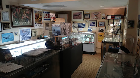
Holley Museum-Military History on the map, Topeka, United States
Photo
Where is located Holley Museum-Military History
Holley Museum-Military History — local attraction, which is located at 420 SE 6th Ave, Topeka, KS 66607, United States and belongs to the category — museum. Average visitor rating for this place — 5.0 (according to 9 ratings, information from open sources and relevant for 2022).
Exact location — Holley Museum-Military History, marked on the map with a red marker.
You can get directions to Holley Museum-Military History on the map from your location.
What else is interesting in Topeka? You can see all the sights if you go to the city page.
Coordinates
Holley Museum-Military History, United States coordinates in decimal format: latitude — 39.05131358636181, longitude — -95.66797207509569. When converted to degrees, minutes, seconds Holley Museum-Military History has the following coordinates: 39°3′4.73 north latitude and -95°40′4.7 east longitude.
Nearby cities
The largest cities that are located nearby:
- Olathe — 77 km
- Overland Park — 88 km
- Kansas City — 95 km
- North Kansas City — 96 km
- Independence — 109 km
- Wichita — 209 km
- Lincoln — 213 km
- Omaha — 244 km
- Springfield — 294 km
- Tulsa — 322 km
- Des Moines — 330 km
- Oklahoma City — 429 km
- Norman — 452 km
- Saint Louis — 477 km
- Sioux Falls — 503 km
- Peoria — 542 km
- Little Rock — 568 km
- Wichita Falls — 624 km
- Rockford — 646 km
Distance to the capital
Distance to the capital (Washington) is about — 1608 km.