
 Warner Robins
Wantagh
Bethel
Misty Hill Farm
United States
Wakonda Beach (R33) Airport
Wilmington
Poland
Miami International Airport
Warner Robins
Wantagh
Bethel
Misty Hill Farm
United States
Wakonda Beach (R33) Airport
Wilmington
Poland
Miami International Airport
Hubbard Orangutan Forest on the map, Council Bluffs, United States
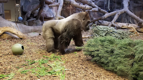
Photo
Where is located Hubbard Orangutan Forest
Hubbard Orangutan Forest — local attraction, which is located at 2119170000, Omaha, NE 68108, United States and belongs to the category — zoo. Average visitor rating for this place — 4.9 (according to 23 ratings, information from open sources and relevant for 2022).
Exact location — Hubbard Orangutan Forest, marked on the map with a red marker.
You can get directions to Hubbard Orangutan Forest on the map from your location.
What else is interesting in Council Bluffs? You can see all the sights if you go to the city page.
Coordinates
Hubbard Orangutan Forest, United States coordinates in decimal format: latitude — 41.2259366672767, longitude — -95.92662277502978. When converted to degrees, minutes, seconds Hubbard Orangutan Forest has the following coordinates: 41°13′33.37 north latitude and -95°55′35.84 east longitude.
Nearby cities
The largest cities that are located nearby:
- Omaha — 11 km
- Lincoln — 84 km
- Des Moines — 190 km
- Topeka — 244 km
- North Kansas City — 259 km
- Sioux Falls — 262 km
- Kansas City — 263 km
- Independence — 270 km
- Overland Park — 272 km
- Olathe — 278 km
- Wichita — 416 km
- Minneapolis — 458 km
- Saint Paul — 462 km
- Springfield — 502 km
- Peoria — 530 km
- Madison — 559 km
- Rockford — 565 km
- Tulsa — 565 km
- Saint Louis — 569 km
Distance to the capital
Distance to the capital (Washington) is about — 1625 km.