
 Warner Robins
Wantagh
Bethel
Misty Hill Farm
United States
Wakonda Beach (R33) Airport
Wilmington
Poland
Miami International Airport
Warner Robins
Wantagh
Bethel
Misty Hill Farm
United States
Wakonda Beach (R33) Airport
Wilmington
Poland
Miami International Airport
Main City Park on the map, Gresham, United States
Photo
Where is located Main City Park
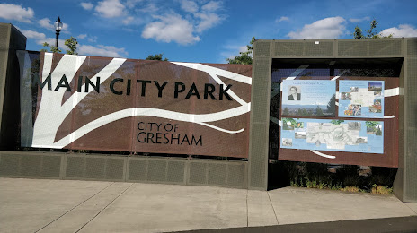
Main City Park — local attraction, which is located at 219 S Main Ave, Gresham, OR 97080, United States and belongs to the category — park. Average visitor rating for this place — 4.4 (according to 897 ratings, information from open sources and relevant for 2022).
Exact location — Main City Park, marked on the map with a red marker.
You can get directions to Main City Park on the map from your location.
What else is interesting in Gresham? You can see all the sights if you go to the city page.
Coordinates
Main City Park, United States coordinates in decimal format: latitude — 45.49612018704778, longitude — -122.43012652489203. When converted to degrees, minutes, seconds Main City Park has the following coordinates: 45°29′46.03 north latitude and -122°25′48.46 east longitude.
Nearby cities
The largest cities that are located nearby:
- Portland — 19 km
- Vancouver — 24 km
- Salem — 78 km
- Eugene — 168 km
- Tacoma — 194 km
- Seattle — 233 km
- Bellevue — 234 km
- Victoria
 (Canada) — 331 km
 - Abbotsford (Canada) — 393 km
- Delta (Canada) — 400 km
- Surrey (Canada) — 408 km
- Richmond (Canada) — 409 km
- Burnaby (Canada) — 418 km
- Coquitlam (Canada) — 419 km
- Anmore (Canada) — 423 km
- Spokane — 443 km
- Kelowna (Canada) — 528 km
- Boise — 539 km
- Reno — 697 km
Distance to the capital
Distance to the capital (Washington) is about — 3760 km.