
 Warner Robins
Wantagh
Bethel
Misty Hill Farm
United States
Wakonda Beach (R33) Airport
Wilmington
Poland
Miami International Airport
Warner Robins
Wantagh
Bethel
Misty Hill Farm
United States
Wakonda Beach (R33) Airport
Wilmington
Poland
Miami International Airport
Monticello on the map, Charlottesville, United States
Photo
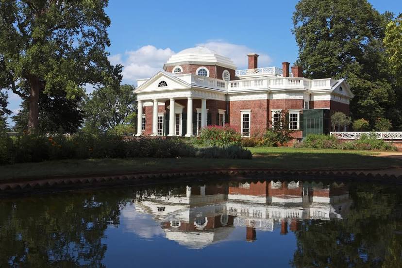
Where is located Monticello
Monticello — local attraction, which is located at 931 Thomas Jefferson Pkwy, Charlottesville, VA 22902, United States and belongs to the category — historical landmark. Average visitor rating for this place — 4.7 (according to 6718 ratings, information from open sources and relevant for 2022).
Exact location — Monticello, marked on the map with a red marker.
You can get directions to Monticello on the map from your location.
What else is interesting in Charlottesville? You can see all the sights if you go to the city page.
Coordinates
Monticello, United States coordinates in decimal format: latitude — 38.00856623920077, longitude — -78.45326377512623. When converted to degrees, minutes, seconds Monticello has the following coordinates: 38°0′30.84 north latitude and -78°27′11.75 east longitude.
Nearby cities
The largest cities that are located nearby:
- Richmond — 106 km
- Alexandria — 150 km
- Baltimore — 212 km
- Hampton — 218 km
- Durham — 228 km
- Norfolk — 234 km
- Chesapeake — 239 km
- Greensboro — 246 km
- Cary — 249 km
- Raleigh — 249 km
- Virginia Beach — 256 km
- Winston-Salem — 265 km
- Pittsburgh — 296 km
- Fayetteville — 331 km
- Philadelphia — 352 km
- Charlotte — 376 km
- Allentown — 380 km
- Toms River — 420 km
- Akron — 422 km
Distance to the capital
Distance to the capital (Washington) is about — 159 km.