
 Warner Robins
Wantagh
Bethel
Misty Hill Farm
United States
Wakonda Beach (R33) Airport
Wilmington
Poland
Miami International Airport
Warner Robins
Wantagh
Bethel
Misty Hill Farm
United States
Wakonda Beach (R33) Airport
Wilmington
Poland
Miami International Airport
Pavilion at Bobby Ferguson Park on the map, Texarkana, United States
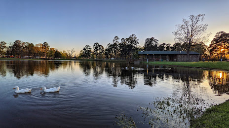
Photo
Where is located Pavilion at Bobby Ferguson Park
Pavilion at Bobby Ferguson Park — local attraction, which is located at 3400 U of A Way, Texarkana, AR 71854, United States and belongs to the category — park. Average visitor rating for this place — 4.4 (according to 151 rating, information from open sources and relevant for 2022).
Exact location — Pavilion at Bobby Ferguson Park, marked on the map with a red marker.
You can get directions to Pavilion at Bobby Ferguson Park on the map from your location.
What else is interesting in Texarkana? You can see all the sights if you go to the city page.
Coordinates
Pavilion at Bobby Ferguson Park, United States coordinates in decimal format: latitude — 33.47356500867798, longitude — -94.00515767525064. When converted to degrees, minutes, seconds Pavilion at Bobby Ferguson Park has the following coordinates: 33°28′24.83 north latitude and -94°0′18.57 east longitude.
Nearby cities
The largest cities that are located nearby:
- Shreveport — 103 km
- Little Rock — 216 km
- Garland — 247 km
- Mesquite — 248 km
- Plano — 250 km
- Richardson — 254 km
- Frisco — 259 km
- Dallas — 265 km
- Carrollton — 268 km
- Irving — 278 km
- Grand Prairie — 284 km
- Denton — 286 km
- Arlington — 295 km
- Fort Worth — 314 km
- Tulsa — 348 km
- Waco — 358 km
- Norman — 365 km
- Beaumont — 370 km
- Jackson — 382 km
Distance to the capital
Distance to the capital (Washington) is about — 1635 km.