
 Warner Robins
Wantagh
Bethel
Misty Hill Farm
United States
Wakonda Beach (R33) Airport
Wilmington
Poland
Miami International Airport
Warner Robins
Wantagh
Bethel
Misty Hill Farm
United States
Wakonda Beach (R33) Airport
Wilmington
Poland
Miami International Airport
Vicksburg National Battlefield on the map, Vicksburg, United States
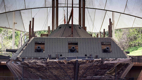
Photo
Where is located Vicksburg National Battlefield
Vicksburg National Battlefield — local attraction, which is located at I20 Frontage Rd, Vicksburg, MS 39183, United States and belongs to the category — historical landmark. Average visitor rating for this place — 4.6 (according to 116 ratings, information from open sources and relevant for 2022).
Exact location — Vicksburg National Battlefield, marked on the map with a red marker.
You can get directions to Vicksburg National Battlefield on the map from your location.
What else is interesting in Vicksburg? You can see all the sights if you go to the city page.
Coordinates
Vicksburg National Battlefield, United States coordinates in decimal format: latitude — 32.34939460088226, longitude — -90.84850475510422. When converted to degrees, minutes, seconds Vicksburg National Battlefield has the following coordinates: 32°20′57.82 north latitude and -90°50′54.62 east longitude.
Nearby cities
The largest cities that are located nearby:
- Jackson — 65 km
- Baton Rouge — 211 km
- Lafayette — 259 km
- Shreveport — 268 km
- Metairie — 271 km
- New Orleans — 277 km
- Little Rock — 294 km
- Memphis — 318 km
- Mobile — 326 km
- Birmingham — 397 km
- Beaumont — 400 km
- Montgomery — 428 km
- Huntsville — 470 km
- Houston — 518 km
- Mesquite — 534 km
- Garland — 538 km
- Plano — 545 km
- Richardson — 547 km
- Dallas — 552 km
Distance to the capital
Distance to the capital (Washington) is about — 1444 km.