
 Warner Robins
Wantagh
Bethel
Misty Hill Farm
United States
Wakonda Beach (R33) Airport
Wilmington
Poland
Miami International Airport
Warner Robins
Wantagh
Bethel
Misty Hill Farm
United States
Wakonda Beach (R33) Airport
Wilmington
Poland
Miami International Airport
Roads and Rails Museum on the map, Frederick, United States
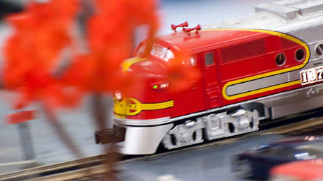
Photo
Where is located Roads and Rails Museum
Roads and Rails Museum — local attraction, which is located at 200 N East St, Frederick, MD 21701, United States and belongs to the category — museum. Average visitor rating for this place — 4.4 (according to 186 ratings, information from open sources and relevant for 2022).
Exact location — Roads and Rails Museum, marked on the map with a red marker.
You can get directions to Roads and Rails Museum on the map from your location.
What else is interesting in Frederick? You can see all the sights if you go to the city page.
Coordinates
Roads and Rails Museum, United States coordinates in decimal format: latitude — 39.41639148087994, longitude — -77.40495077508479. When converted to degrees, minutes, seconds Roads and Rails Museum has the following coordinates: 39°24′59.01 north latitude and -77°24′17.82 east longitude.
Nearby cities
The largest cities that are located nearby:
- Baltimore — 70 km
- Alexandria — 74 km
- Philadelphia — 199 km
- Richmond — 207 km
- Allentown — 208 km
- Pittsburgh — 245 km
- Toms River — 279 km
- Hampton — 280 km
- Edison — 280 km
- Norfolk — 300 km
- Elizabeth — 302 km
- Newark — 308 km
- Chesapeake — 309 km
- Virginia Beach — 310 km
- Paterson — 318 km
- New York — 319 km
- Brooklyn — 319 km
- Yonkers — 338 km
- Stamford — 370 km
Distance to the capital
Distance to the capital (Washington) is about — 65 km.