
 Warner Robins
Wantagh
Bethel
Misty Hill Farm
United States
Wakonda Beach (R33) Airport
Wilmington
Poland
Miami International Airport
Warner Robins
Wantagh
Bethel
Misty Hill Farm
United States
Wakonda Beach (R33) Airport
Wilmington
Poland
Miami International Airport
Tuscawilla Park on the map, Daytona Beach, United States
Photo
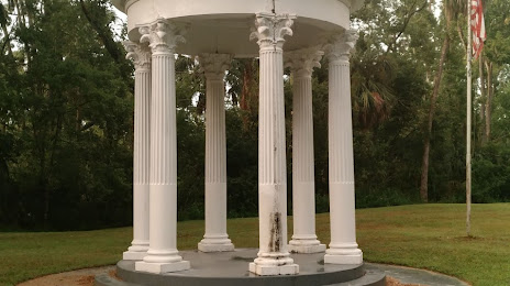
Where is located Tuscawilla Park
Tuscawilla Park — local attraction, which is located at 1000 Orange Ave, Daytona Beach, FL 32114, United States and belongs to the category — park. Average visitor rating for this place — 4.1 (according to 386 ratings, information from open sources and relevant for 2022).
Exact location — Tuscawilla Park, marked on the map with a red marker.
You can get directions to Tuscawilla Park on the map from your location.
What else is interesting in Daytona Beach? You can see all the sights if you go to the city page.
Coordinates
Tuscawilla Park, United States coordinates in decimal format: latitude — 29.199797237653236, longitude — -81.04014747535506. When converted to degrees, minutes, seconds Tuscawilla Park has the following coordinates: 29°11′59.27 north latitude and -81°2′24.53 east longitude.
Nearby cities
The largest cities that are located nearby:
- Orlando — 82 km
- Gainesville — 134 km
- Jacksonville — 138 km
- Brandon — 187 km
- Tampa — 198 km
- Clearwater — 222 km
- Port Saint Lucie — 224 km
- Saint Petersburg — 224 km
- Cape Coral — 307 km
- Savannah — 318 km
- Coral Springs — 333 km
- Tallahassee — 339 km
- Fort Lauderdale — 353 km
- Pembroke Pines — 361 km
- Miramar — 364 km
- Hollywood — 364 km
- Hialeah — 378 km
- Miami — 390 km
- Charleston — 407 km
Distance to the capital
Distance to the capital (Washington) is about — 1141 km.