
 Warner Robins
Wantagh
Bethel
Misty Hill Farm
United States
Wakonda Beach (R33) Airport
Wilmington
Poland
Miami International Airport
Warner Robins
Wantagh
Bethel
Misty Hill Farm
United States
Wakonda Beach (R33) Airport
Wilmington
Poland
Miami International Airport
Clinton County Historical Association and Museum on the map, Plattsburgh, United States
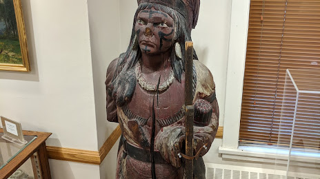
Photo
Where is located Clinton County Historical Association and Museum
Clinton County Historical Association and Museum — local attraction, which is located at 98 Ohio Ave, Plattsburgh, NY 12903, United States and belongs to the category — historical society. Average visitor rating for this place — 4.7 (according to 20 ratings, information from open sources and relevant for 2022).
Exact location — Clinton County Historical Association and Museum, marked on the map with a red marker.
You can get directions to Clinton County Historical Association and Museum on the map from your location.
What else is interesting in Plattsburgh? You can see all the sights if you go to the city page.
Coordinates
Clinton County Historical Association and Museum, United States coordinates in decimal format: latitude — 44.68293565176806, longitude — -73.44595217491904. When converted to degrees, minutes, seconds Clinton County Historical Association and Museum has the following coordinates: 44°40′58.57 north latitude and -73°26′45.43 east longitude.
Nearby cities
The largest cities that are located nearby:
- Montreal
 (Canada) — 89 km
 - Longueuil (Canada) — 93 km
- Laval (Canada) — 102 km
- Sherbrooke (Canada) — 144 km
- Ottawa (Canada) — 192 km
- Gatineau (Canada) — 194 km
- Trois-Rivières (Canada) — 195 km
- Kingston (Canada) — 246 km
- Manchester — 248 km
- Amherst — 272 km
- Levis (Canada) — 281 km
- Syracuse — 284 km
- Quebec (Canada) — 286 km
- Lowell — 287 km
- Springfield — 296 km
- Worcester — 301 km
- Cambridge — 321 km
- Boston — 324 km
- Hartford — 331 km
Distance to the capital
Distance to the capital (Washington) is about — 708 km.