
 Warner Robins
Wantagh
Bethel
Misty Hill Farm
United States
Wakonda Beach (R33) Airport
Wilmington
Poland
Miami International Airport
Warner Robins
Wantagh
Bethel
Misty Hill Farm
United States
Wakonda Beach (R33) Airport
Wilmington
Poland
Miami International Airport
Hoffman Park on the map, River Falls, United States
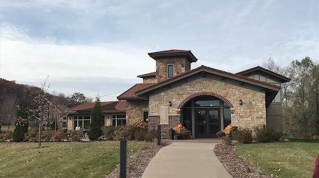
Photo
Where is located Hoffman Park
Hoffman Park — local attraction, which is located at no data and belongs to the category — -. Average visitor rating for this place — 4.5 (according to 110 ratings, information from open sources and relevant for 2022).
Exact location — Hoffman Park, marked on the map with a red marker.
You can get directions to Hoffman Park on the map from your location.
What else is interesting in River Falls? You can see all the sights if you go to the city page.
Coordinates
Hoffman Park, United States coordinates in decimal format: latitude — 44.856706254889204, longitude — -92.67716937491339. When converted to degrees, minutes, seconds Hoffman Park has the following coordinates: 44°51′24.14 north latitude and -92°40′37.81 east longitude.
Nearby cities
The largest cities that are located nearby:
- Saint Paul — 38 km
- Minneapolis — 52 km
- Madison — 327 km
- Sioux Falls — 360 km
- Green Bay — 365 km
- Des Moines — 370 km
- Rockford — 407 km
- Milwaukee — 431 km
- Omaha — 488 km
- Aurora — 493 km
- Naperville — 504 km
- Peoria — 526 km
- Joliet — 527 km
- Chicago — 527 km
- Lincoln — 561 km
- Grand Rapids — 601 km
- South Bend — 633 km
- Winnipeg
 (Canada) — 643 km
 - North Kansas City — 654 km
Distance to the capital
Distance to the capital (Washington) is about — 1451 km.