 Betteshanger
Lynton
Amesbury
Marlow
Burford
Chipping Norton
Marlborough
Cairnryan
Lydney
Betteshanger
Lynton
Amesbury
Marlow
Burford
Chipping Norton
Marlborough
Cairnryan
Lydney
Santa-Fe Fun Park on the map, Swanage, United Kingdom
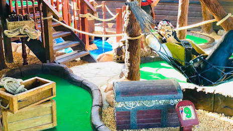
Photo
Where is located Santa-Fe Fun Park
Santa-Fe Fun Park — local attraction, which is located at The Pavillion, Shore Rd, Swanage BH19 1LD, United Kingdom and belongs to the category — miniature golf course. Average visitor rating for this place — 4.0 (according to 130 ratings, information from open sources and relevant for 2022).
Exact location — Santa-Fe Fun Park, marked on the map with a red marker.
You can get directions to Santa-Fe Fun Park on the map from your location.
What else is interesting in Swanage? You can see all the sights if you go to the city page.
Coordinates
Santa-Fe Fun Park, United Kingdom coordinates in decimal format: latitude — 50.61019464150853, longitude — -1.9580051747133929. When converted to degrees, minutes, seconds Santa-Fe Fun Park has the following coordinates: 50°36′36.7 north latitude and -1°57′28.82 east longitude.
Nearby cities
The largest cities that are located nearby:
- Bournemouth — 13 km
- Southampton — 51 km
- Portsmouth — 65 km
- Bristol — 103 km
- Swindon — 105 km
- Exeter — 111 km
- Reading — 115 km
- Crawley — 135 km
- Oxford — 135 km
- Slough — 137 km
- Cheltenham — 143 km
- Sutton — 148 km
- Watford — 158 km
- Eastbourne — 158 km
- Luton — 175 km
- Worcester — 176 km
- Le Havre
 (France) — 193 km
 - Gillingham — 194 km
- Northampton — 194 km
Distance to the capital
Distance to the capital (London) is about — 162 km.