 Betteshanger
Lynton
Amesbury
Marlow
Burford
Chipping Norton
Marlborough
Cairnryan
Lydney
Betteshanger
Lynton
Amesbury
Marlow
Burford
Chipping Norton
Marlborough
Cairnryan
Lydney
Drumpellier Country Park on the map, Bellshill, United Kingdom
Photo
Where is located Drumpellier Country Park
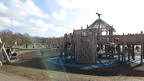
Drumpellier Country Park — local attraction, which is located at Townhead Rd, Coatbridge ML5 1RX, United Kingdom and belongs to the category — country park. Average visitor rating for this place — 4.5 (according to 1043 ratings, information from open sources and relevant for 2022).
Exact location — Drumpellier Country Park, marked on the map with a red marker.
You can get directions to Drumpellier Country Park on the map from your location.
What else is interesting in Bellshill? You can see all the sights if you go to the city page.
Coordinates
Drumpellier Country Park, United Kingdom coordinates in decimal format: latitude — 55.873595494657344, longitude — -4.072913174515324. When converted to degrees, minutes, seconds Drumpellier Country Park has the following coordinates: 55°52′24.94 north latitude and -4°4′22.49 east longitude.
Nearby cities
The largest cities that are located nearby:
- Glasgow — 15 km
- Edinburgh — 54 km
- Belfast — 182 km
- Sunderland — 196 km
- Preston — 243 km
- Blackburn — 250 km
- Liverpool — 275 km
- Huddersfield — 281 km
- Manchester — 284 km
- Dublin
 (Ireland) — 310 km
 - Rotherham — 317 km
- Sheffield — 318 km
- Stoke-on-Trent — 335 km
- Telford — 363 km
- Dudley — 388 km
- Sutton Coldfield — 388 km
- West Bromwich — 390 km
- Birmingham — 395 km
- Leicester — 401 km
Distance to the capital
Distance to the capital (London) is about — 551 km.