 Betteshanger
Lynton
Amesbury
Marlow
Burford
Chipping Norton
Marlborough
Cairnryan
Lydney
Betteshanger
Lynton
Amesbury
Marlow
Burford
Chipping Norton
Marlborough
Cairnryan
Lydney
Mynydd Allt-y-grug on the map, Neath, United Kingdom
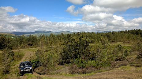
Photo
Where is located Mynydd Allt-y-grug
Mynydd Allt-y-grug — local attraction, which is located at 338 m and belongs to the category — -. Average visitor rating for this place — 4.0 (according to 1 rating, information from open sources and relevant for 2022).
Exact location — Mynydd Allt-y-grug, marked on the map with a red marker.
You can get directions to Mynydd Allt-y-grug on the map from your location.
What else is interesting in Neath? You can see all the sights if you go to the city page.
Coordinates
Mynydd Allt-y-grug, United Kingdom coordinates in decimal format: latitude — 51.75556456172321, longitude — -3.812931690394285. When converted to degrees, minutes, seconds Mynydd Allt-y-grug has the following coordinates: 51°45′20.03 north latitude and -3°48′46.55 east longitude.
Nearby cities
The largest cities that are located nearby:
- Bristol — 87 km
- Exeter — 105 km
- Cheltenham — 121 km
- Worcester — 123 km
- Swindon — 140 km
- Telford — 145 km
- Dudley — 150 km
- West Bromwich — 155 km
- Birmingham — 158 km
- Sutton Coldfield — 167 km
- Bournemouth — 170 km
- Oxford — 175 km
- Coventry — 175 km
- Stoke-on-Trent — 184 km
- Southampton — 187 km
- Reading — 196 km
- Liverpool — 201 km
- Northampton — 207 km
- Leicester — 209 km
Distance to the capital
Distance to the capital (London) is about — 256 km.