 Betteshanger
Lynton
Amesbury
Marlow
Burford
Chipping Norton
Marlborough
Cairnryan
Lydney
Betteshanger
Lynton
Amesbury
Marlow
Burford
Chipping Norton
Marlborough
Cairnryan
Lydney
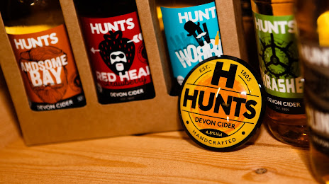
Hunt's Cider on the map, Paignton, United Kingdom
Photo
Where is located Hunt's Cider
Hunt's Cider — local attraction, which is located at Broadleigh Farm, Stoke Gabriel, Totnes TQ9 6PU, United Kingdom and belongs to the category — cider mill. Average visitor rating for this place — 4.4 (according to 44 ratings, information from open sources and relevant for 2022).
Exact location — Hunt's Cider, marked on the map with a red marker.
You can get directions to Hunt's Cider on the map from your location.
What else is interesting in Paignton? You can see all the sights if you go to the city page.
Coordinates
Hunt's Cider, United Kingdom coordinates in decimal format: latitude — 50.41721079781385, longitude — -3.617361374814975. When converted to degrees, minutes, seconds Hunt's Cider has the following coordinates: 50°25′1.96 north latitude and -3°37′2.5 east longitude.
Nearby cities
The largest cities that are located nearby:
- Exeter — 31 km
- Bournemouth — 122 km
- Bristol — 131 km
- Southampton — 159 km
- Swindon — 174 km
- Portsmouth — 178 km
- Cheltenham — 191 km
- Reading — 211 km
- Worcester — 215 km
- Oxford — 215 km
- Brest
 (France) — 236 km
 - Slough — 236 km
- Crawley — 246 km
- Dudley — 250 km
- Birmingham — 253 km
- West Bromwich — 253 km
- Sutton — 254 km
- Watford — 256 km
- Coventry — 258 km
Distance to the capital
Distance to the capital (London) is about — 273 km.