 Betteshanger
Lynton
Amesbury
Marlow
Burford
Chipping Norton
Marlborough
Cairnryan
Lydney
Betteshanger
Lynton
Amesbury
Marlow
Burford
Chipping Norton
Marlborough
Cairnryan
Lydney
Quoile Castle on the map, Downpatrick, United Kingdom
Photo
Where is located Quoile Castle
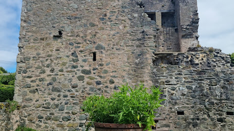
Quoile Castle — local attraction, which is located at Quay Rd, Downpatrick BT30 7JB, United Kingdom and belongs to the category — historical landmark. Average visitor rating for this place — 4.6 (according to 101 rating, information from open sources and relevant for 2022).
Exact location — Quoile Castle, marked on the map with a red marker.
You can get directions to Quoile Castle on the map from your location.
What else is interesting in Downpatrick? You can see all the sights if you go to the city page.
Coordinates
Quoile Castle, United Kingdom coordinates in decimal format: latitude — 54.349828714522104, longitude — -5.699500374668633. When converted to degrees, minutes, seconds Quoile Castle has the following coordinates: 54°20′59.38 north latitude and -5°41′58.2 east longitude.
Nearby cities
The largest cities that are located nearby:
- Belfast — 33 km
- Dublin
 (Ireland) — 114 km
 - Glasgow — 193 km
- Liverpool — 206 km
- Preston — 207 km
- Blackburn — 221 km
- Edinburgh — 238 km
- Manchester — 247 km
- Huddersfield — 268 km
- Stoke-on-Trent — 277 km
- Sunderland — 283 km
- Telford — 285 km
- Sheffield — 299 km
- Rotherham — 303 km
- Dudley — 316 km
- West Bromwich — 321 km
- Sutton Coldfield — 326 km
- Birmingham — 328 km
- Cork (Ireland) — 329 km
Distance to the capital
Distance to the capital (London) is about — 489 km.