
 Warner Robins
Wantagh
Bethel
Misty Hill Farm
United States
Wakonda Beach (R33) Airport
Wilmington
Poland
Miami International Airport
Warner Robins
Wantagh
Bethel
Misty Hill Farm
United States
Wakonda Beach (R33) Airport
Wilmington
Poland
Miami International Airport
Black Creek Ravines Conservation Area on the map, Middleburg, United States
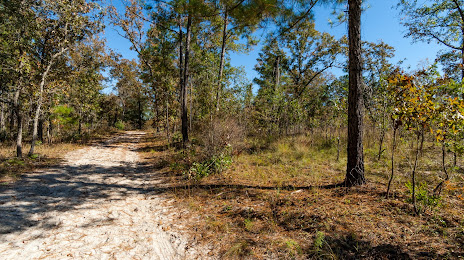
Photo
Where is located Black Creek Ravines Conservation Area
Black Creek Ravines Conservation Area — local attraction, which is located at 5703 Green Rd, Middleburg, FL 32068, United States and belongs to the category — nature preserve. Average visitor rating for this place — 4.5 (according to 162 ratings, information from open sources and relevant for 2022).
Exact location — Black Creek Ravines Conservation Area, marked on the map with a red marker.
You can get directions to Black Creek Ravines Conservation Area on the map from your location.
What else is interesting in Middleburg? You can see all the sights if you go to the city page.
Coordinates
Black Creek Ravines Conservation Area, United States coordinates in decimal format: latitude — 30.057800494760333, longitude — -81.84684227533515. When converted to degrees, minutes, seconds Black Creek Ravines Conservation Area has the following coordinates: 30°3′28.08 north latitude and -81°50′48.63 east longitude.
Nearby cities
The largest cities that are located nearby:
- Jacksonville — 30 km
- Gainesville — 70 km
- Orlando — 177 km
- Savannah — 230 km
- Tallahassee — 238 km
- Brandon — 243 km
- Tampa — 245 km
- Clearwater — 255 km
- Saint Petersburg — 269 km
- Port Saint Lucie — 343 km
- Charleston — 344 km
- Cape Coral — 391 km
- Columbia — 437 km
- Coral Springs — 450 km
- Atlanta — 468 km
- Fort Lauderdale — 470 km
- Pembroke Pines — 477 km
- Miramar — 479 km
- Hollywood — 481 km
Distance to the capital
Distance to the capital (Washington) is about — 1078 km.