 Betteshanger
Lynton
Amesbury
Marlow
Burford
Chipping Norton
Marlborough
Cairnryan
Lydney
Betteshanger
Lynton
Amesbury
Marlow
Burford
Chipping Norton
Marlborough
Cairnryan
Lydney
Splash on the map, Cookstown, United Kingdom
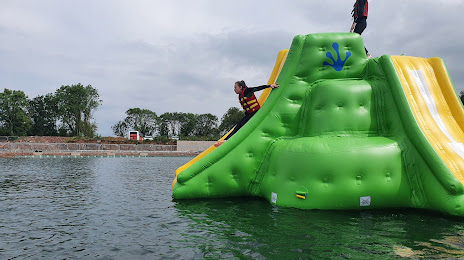
Photo
Where is located Splash
Splash — local attraction, which is located at Maghadone Rd, Magherafelt BT45 7SW, United Kingdom and belongs to the category — water park. Average visitor rating for this place — 5.0 (according to 35 ratings, information from open sources and relevant for 2022).
Exact location — Splash, marked on the map with a red marker.
You can get directions to Splash on the map from your location.
What else is interesting in Cookstown? You can see all the sights if you go to the city page.
Coordinates
Splash, United Kingdom coordinates in decimal format: latitude — 54.64730404522587, longitude — -6.748276374562683. When converted to degrees, minutes, seconds Splash has the following coordinates: 54°38′50.29 north latitude and -6°44′53.79 east longitude.
Nearby cities
The largest cities that are located nearby:
- Belfast — 52 km
- Dublin
 (Ireland) — 146 km
 - Glasgow — 205 km
- Edinburgh — 264 km
- Preston — 281 km
- Liverpool — 282 km
- Blackburn — 295 km
- Manchester — 323 km
- Cork (Ireland) — 326 km
- Sunderland — 342 km
- Huddersfield — 343 km
- Stoke-on-Trent — 354 km
- Telford — 361 km
- Sheffield — 375 km
- Rotherham — 379 km
- Dudley — 392 km
- West Bromwich — 397 km
- Sutton Coldfield — 402 km
- Birmingham — 404 km
Distance to the capital
Distance to the capital (London) is about — 563 km.