 Betteshanger
Lynton
Amesbury
Marlow
Burford
Chipping Norton
Marlborough
Cairnryan
Lydney
Betteshanger
Lynton
Amesbury
Marlow
Burford
Chipping Norton
Marlborough
Cairnryan
Lydney
Ferguslie Gardens on the map, Paisley, United Kingdom
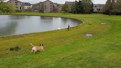
Photo
Where is located Ferguslie Gardens
Ferguslie Gardens — local attraction, which is located at 62 Well St, Paisley PA1 2QT, United Kingdom and belongs to the category — park. Average visitor rating for this place — 4.3 (according to 200 ratings, information from open sources and relevant for 2022).
Exact location — Ferguslie Gardens, marked on the map with a red marker.
You can get directions to Ferguslie Gardens on the map from your location.
What else is interesting in Paisley? You can see all the sights if you go to the city page.
Coordinates
Ferguslie Gardens, United Kingdom coordinates in decimal format: latitude — 55.84262167304758, longitude — -4.449141974516572. When converted to degrees, minutes, seconds Ferguslie Gardens has the following coordinates: 55°50′33.44 north latitude and -4°26′56.91 east longitude.
Nearby cities
The largest cities that are located nearby:
- Glasgow — 12 km
- Edinburgh — 78 km
- Belfast — 168 km
- Sunderland — 220 km
- Preston — 257 km
- Blackburn — 265 km
- Liverpool — 286 km
- Manchester — 299 km
- Huddersfield — 299 km
- Dublin
 (Ireland) — 301 km
 - Rotherham — 335 km
- Sheffield — 336 km
- Stoke-on-Trent — 349 km
- Telford — 375 km
- Dudley — 401 km
- Sutton Coldfield — 403 km
- West Bromwich — 403 km
- Birmingham — 409 km
- Leicester — 418 km
Distance to the capital
Distance to the capital (London) is about — 560 km.