 Betteshanger
Lynton
Amesbury
Marlow
Burford
Chipping Norton
Marlborough
Cairnryan
Lydney
Betteshanger
Lynton
Amesbury
Marlow
Burford
Chipping Norton
Marlborough
Cairnryan
Lydney
King Arthur's Round Table on the map, Penrith, United Kingdom
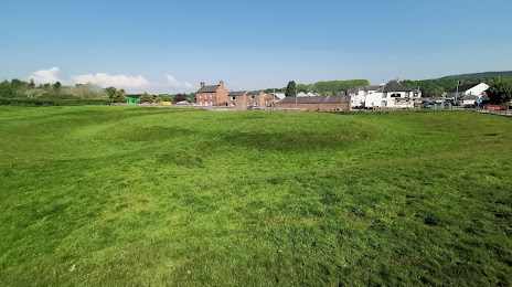
Photo
Where is located King Arthur's Round Table
King Arthur's Round Table — local attraction, which is located at B5320, Penrith CA10 2BX, United Kingdom and belongs to the category — historical landmark. Average visitor rating for this place — 3.4 (according to 160 ratings, information from open sources and relevant for 2022).
Exact location — King Arthur's Round Table, marked on the map with a red marker.
You can get directions to King Arthur's Round Table on the map from your location.
What else is interesting in Penrith? You can see all the sights if you go to the city page.
Coordinates
King Arthur's Round Table, United Kingdom coordinates in decimal format: latitude — 54.648023245720296, longitude — -2.740517574562657. When converted to degrees, minutes, seconds King Arthur's Round Table has the following coordinates: 54°38′52.88 north latitude and -2°44′25.86 east longitude.
Nearby cities
The largest cities that are located nearby:
- Sunderland — 91 km
- Preston — 100 km
- Blackburn — 103 km
- Huddersfield — 129 km
- Manchester — 135 km
- Liverpool — 140 km
- Edinburgh — 145 km
- Glasgow — 162 km
- Rotherham — 164 km
- Sheffield — 165 km
- Stoke-on-Trent — 188 km
- Belfast — 204 km
- Telford — 221 km
- Sutton Coldfield — 240 km
- Dudley — 242 km
- West Bromwich — 243 km
- Birmingham — 248 km
- Leicester — 249 km
- Coventry — 263 km
Distance to the capital
Distance to the capital (London) is about — 390 km.