 Betteshanger
Lynton
Amesbury
Marlow
Burford
Chipping Norton
Marlborough
Cairnryan
Lydney
Betteshanger
Lynton
Amesbury
Marlow
Burford
Chipping Norton
Marlborough
Cairnryan
Lydney
National Trust - Boarstall Tower on the map, Aylesbury, United Kingdom
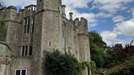
Photo
Where is located National Trust - Boarstall Tower
National Trust - Boarstall Tower — local attraction, which is located at Boarstall Tower, Bicester HP18 9UX, United Kingdom and belongs to the category — $$. Average visitor rating for this place — 3.9 (according to 34 ratings, information from open sources and relevant for 2022).
Exact location — National Trust - Boarstall Tower, marked on the map with a red marker.
You can get directions to National Trust - Boarstall Tower on the map from your location.
What else is interesting in Aylesbury? You can see all the sights if you go to the city page.
Coordinates
National Trust - Boarstall Tower, United Kingdom coordinates in decimal format: latitude — 51.823203938456324, longitude — -1.095637674668951. When converted to degrees, minutes, seconds National Trust - Boarstall Tower has the following coordinates: 51°49′23.53 north latitude and -1°5′44.3 east longitude.
Nearby cities
The largest cities that are located nearby:
- Luton — 27 km
- Oxford — 32 km
- Watford — 34 km
- Slough — 37 km
- Reading — 42 km
- Northampton — 47 km
- Sutton — 66 km
- Swindon — 73 km
- Cambridge — 76 km
- Coventry — 81 km
- Cheltenham — 87 km
- Chelmsford — 88 km
- Crawley — 89 km
- Basildon — 93 km
- Leicester — 93 km
- Birmingham — 104 km
- Worcester — 105 km
- Gillingham — 105 km
- Sutton Coldfield — 108 km
Distance to the capital
Distance to the capital (London) is about — 75 km.