 Betteshanger
Lynton
Amesbury
Marlow
Burford
Chipping Norton
Marlborough
Cairnryan
Lydney
Betteshanger
Lynton
Amesbury
Marlow
Burford
Chipping Norton
Marlborough
Cairnryan
Lydney
Galley & Warden Hills on the map, Luton, United Kingdom
Photo
Where is located Galley & Warden Hills
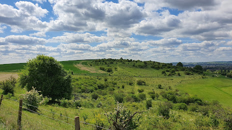
Galley & Warden Hills — local attraction, which is located at Warden Hill Rd, Luton LU2 7AE, United Kingdom and belongs to the category — nature preserve. Average visitor rating for this place — 4.7 (according to 106 ratings, information from open sources and relevant for 2022).
Exact location — Galley & Warden Hills, marked on the map with a red marker.
You can get directions to Galley & Warden Hills on the map from your location.
What else is interesting in Luton? You can see all the sights if you go to the city page.
Coordinates
Galley & Warden Hills, United Kingdom coordinates in decimal format: latitude — 51.926454257096196, longitude — -0.414631707011137. When converted to degrees, minutes, seconds Galley & Warden Hills has the following coordinates: 51°55′35.24 north latitude and -0°24′52.67 east longitude.
Nearby cities
The largest cities that are located nearby:
- Watford — 25 km
- Slough — 42 km
- Cambridge — 51 km
- Northampton — 52 km
- Oxford — 59 km
- Sutton — 59 km
- Reading — 61 km
- Chelmsford — 63 km
- Basildon — 71 km
- Southend-on-Sea — 86 km
- Gillingham — 86 km
- Crawley — 87 km
- Coventry — 94 km
- Leicester — 97 km
- Swindon — 100 km
- Ipswich — 108 km
- Cheltenham — 113 km
- Birmingham — 120 km
- Sutton Coldfield — 121 km
Distance to the capital
Distance to the capital (London) is about — 51 km.