Bethesda — Minturn
Bethesda — Bar Harbor
Bethesda — Thomson
Bethesda — Blue Eye
Bethesda — Ophelia
Bethesda — Gulf Shores
Bethesda — Winburne
Bethesda — San Luis
Bethesda — Santaquin
Bethesda — Trumann
Bethesda — Russell
Bethesda — Talihina
Bethesda — Valley Head
Bethesda — Cloverdale
Bethesda — Shaw
Bethesda — Jenners
Bethesda — Lake Junaluska
Bethesda — Fincastle
Bethesda — East Brookfield
Derwood
Germantown
Ijamsville
Frederick
Braddock Heights
Myersville
Boonsboro
Cavetown
Hagerstown
Clear Spring
Breezewood
Schellsburg
Shanksville
Friedens
Somerset
Acosta
Jones Mills
Donegal
Armbrust
New Stanton
Rillton
Irwin
Westmoreland City
Murrysville
Monroeville
New Kensington
Bakerstown
Gibsonia
Wexford
Cranberry Township
Zelienople
Beaver Falls
Ellwood City
Enon Valley
New Middletown
North Lima
Canfield
Austintown
Newton Falls
Garrettsville
Streetsboro
Twinsburg
Peninsula
Richfield
Brecksville
Strongsville
Middleburg Heights
Berea
North Olmsted
North Ridgeville
Elyria
Berlin Heights
Milan Township
Sandusky
Vickery
Sandusky County
Lindsey
Elmore
Stony Ridge
Perrysburg
Maumee
Toledo Express Airport
Swanton
Delta
Wauseon
Archbold
Kunkle
Montpelier
Fremont
Glen Eden
Mongo
Sturgis
Middlebury
Bristol
Elkhart
Granger
Notre Dame
Roseland
Galien
Rolling Prairie
La Porte
Westville
Chesterton
Hobart
Gary
Griffith
Hammond
Munster
South Holland
Markham
Hazel Crest
Tinley Park
Mokena
Joliet
Channahon
Minooka
Marseilles
Ottawa
Ottawa Airport
LaSalle
Seatonville
Bureau County
Wyanet
Buda
Annawan
Geneseo
Colona
East Moline
Terminal, MLI
Rock Island
Davenport
Walcott
Stockton
Iowa City
Coralville
Conroy
Ladora
Grinnell
Santiago
Bondurant
Des Moines
Windsor Heights
Clive
Waukee
Earlham
Stuart
Anita
Neola
McClelland
Council Bluffs
Omaha
Omaha
Gretna
Sarpy County
South Bend
Lincoln
Pleasant Dale
Beaver Crossing
York
Aurora
Giltner
Alda
Gibbon
Kearney
Lexington
Cozad
Gothenburg
North Platte
Hershey
Ogallala
Julesburg
Chappell
Lodgepole
Kimball
Cheyenne
Laramie
Elk Mountain
Sinclair
Rawlins
Rock Springs
Lyman
Fort Bridger
Coalville
Park City
Holladay
Red Lion-Sheraton Hotel Heliport
Salt Lake City
Magna
Wendover
West Wendover
Wells
Halleck
Elko
Carlin
Battle Mountain
Winnemucca
Imlay
Lovelock
Fernley
Sparks
Reno
Floriston
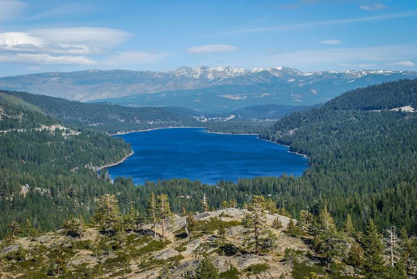
Bethesda — Truckee distance, route on the map
Distance by car
Distance between Bethesda, Maryland, United States and Truckee, California, United States by car is — km, or miles. To travel this distance by car, you need minute, or h.
Route on the map, driving directions
Car route Bethesda — Truckee was created automatically. The road on the map is shown as a blue line. By moving the markers, you can create a new route through the points you need.
Passing cities through which the car route passes: Potomac, Derwood, Germantown, Ijamsville, Frederick, Braddock Heights, Myersville, Boonsboro, Cavetown, Hagerstown, Clear Spring, Breezewood, Schellsburg, Shanksville, Friedens, Somerset, Acosta, Jones Mills, Donegal, Armbrust, New Stanton, Rillton, Irwin, Westmoreland City, Murrysville, Monroeville, New Kensington, Bakerstown, Gibsonia, Wexford, Cranberry Township, Zelienople, Beaver Falls, Ellwood City, Enon Valley, New Middletown, North Lima, Canfield, Austintown, Newton Falls, Garrettsville, Streetsboro, Twinsburg, Peninsula, Richfield, Brecksville, Strongsville, Middleburg Heights, Berea, North Olmsted, North Ridgeville, Elyria, Berlin Heights, Milan Township, Sandusky, Vickery, Sandusky County, Lindsey, Elmore, Stony Ridge, Perrysburg, Maumee, Toledo Express Airport, Swanton, Delta, Wauseon, Archbold, Kunkle, Montpelier, Fremont, Glen Eden, Mongo, Sturgis, Middlebury, Bristol, Elkhart, Granger, Notre Dame, Roseland, Galien, Rolling Prairie, La Porte, Westville, Chesterton, Hobart, Gary, Griffith, Hammond, Munster, South Holland, Markham, Hazel Crest, Tinley Park, Mokena, Joliet, Channahon, Minooka, Marseilles, Ottawa, Ottawa Airport, LaSalle, Seatonville, Bureau County, Wyanet, Buda, Annawan, Geneseo, Colona, East Moline, Terminal, MLI, Rock Island, Davenport, Walcott, Stockton, Iowa City, Coralville, Conroy, Ladora, Grinnell, Santiago, Bondurant, Des Moines, Windsor Heights, Clive, Waukee, Earlham, Stuart, Anita, Neola, McClelland, Council Bluffs, Omaha, Omaha, Gretna, Sarpy County, South Bend, Lincoln, Pleasant Dale, Beaver Crossing, York, Aurora, Giltner, Alda, Gibbon, Kearney, Lexington, Cozad, Gothenburg, North Platte, Hershey, Ogallala, Julesburg, Chappell, Lodgepole, Kimball, Cheyenne, Laramie, Elk Mountain, Sinclair, Rawlins, Rock Springs, Lyman, Fort Bridger, Coalville, Park City, Holladay, Red Lion-Sheraton Hotel Heliport, Salt Lake City, Magna, Wendover, West Wendover, Wells, Halleck, Elko, Carlin, Battle Mountain, Winnemucca, Imlay, Lovelock, Fernley, Sparks, Reno, Floriston.
Distance by plane
If you decide to take a trip Bethesda Truckee by plane, then you have to fly the distance — 3680 km or 2282 miles. It is marked on the map with a gray line (between two points in a straight line).
Flight time
Estimated flight time Bethesda Truckee by plane at cruising speed 750 km / h will be — 4 h. and 54 min.
Direction of movement
United States, Bethesda — right-hand traffic. United States, Truckee — right-hand traffic.
Difference in time
Bethesda and Truckee are in different time zones. The time difference is 3 hours (UTC -4 America/New_York, UTC -7 America/Los_Angeles).
Interesting Facts
Information on alternative ways to get to your destination.
The length of this distance is about 9.2% of the total length of the equator.
The percentage of the population is clearly shown in the graph:
Bethesda — 52,801, Truckee — 15,771 residents (less by 37,030).
The cost of travel
Calculate the cost of the trip yourself using the fuel consumption calculator, changing the data in the table.