Amsterdam — Louisville
Amsterdam — Medora
Amsterdam — Neosho Falls
Amsterdam — Edinburg
Amsterdam — Lydia
Amsterdam — Chitina
Amsterdam — Imlaystown
Amsterdam — Imler
Amsterdam — Wheeler Ridge
Amsterdam — Chalk
Amsterdam — Kenduskeag
Amsterdam — Mead
Amsterdam — Ontario
Amsterdam — Oak
Amsterdam — Ringgold
Amsterdam — Hephzibah
Amsterdam — Houston
Amsterdam — Mary Esther
Amsterdam — Tracy
Fultonville
Palatine Bridge
Herkimer
Mohawk
Ilion
Utica
Whitesboro
Oriskany
Verona
Oneida
Canastota
Chittenango
Fayetteville
East Syracuse
North Syracuse
Syracuse
Liverpool
Van Buren
Elbridge
Weedsport
Seneca Falls
Oaks Corners
Newark
Shortsville
Pittsford
Rochester
Mumford
Riga
Le Roy
South Byron
Elba
Clarence
Bowmansville
Williamsville
Amherst
Buffalo
Tonawanda
Kenmore
Niagara Falls
Queenston
Amsterdam — Louisville
Amsterdam — Medora
Amsterdam — Neosho Falls
Amsterdam — Edinburg
Amsterdam — Lydia
Amsterdam — Chitina
Amsterdam — Imlaystown
Amsterdam — Imler
Amsterdam — Wheeler Ridge
Amsterdam — Chalk
Amsterdam — Kenduskeag
Amsterdam — Mead
Amsterdam — Ontario
Amsterdam — Oak
Amsterdam — Ringgold
Amsterdam — Hephzibah
Amsterdam — Houston
Amsterdam — Mary Esther
Amsterdam — Tracy
Fultonville
Palatine Bridge
Herkimer
Mohawk
Ilion
Utica
Whitesboro
Oriskany
Verona
Oneida
Canastota
Chittenango
Fayetteville
East Syracuse
North Syracuse
Syracuse
Liverpool
Van Buren
Elbridge
Weedsport
Seneca Falls
Oaks Corners
Newark
Shortsville
Pittsford
Rochester
Mumford
Riga
Le Roy
South Byron
Elba
Clarence
Bowmansville
Williamsville
Amherst
Buffalo
Tonawanda
Kenmore
Niagara Falls
Queenston  Thorold
Saint Catharines
St. Catharines
Lincoln
Grimsby
International airport, hamilton
Hamilton
Hamilton Division
John C. Munro Hamilton International Airport
Brant
Brantford
Paris
Brant County
Burford
Woodstock
Ingersoll
Putnam
Belmont
Kilworth
Komoka
Falconbridge
Poplar Hill
Strathroy
Dejong
Watford
Lambton County
Point Edward
Port Huron
Allenton
Imlay City
Lapeer
Davison
Burton
Flint
Lennon
Morrice
Perry
East Lansing
DeWitt Township
Grand Ledge
Lowell
Grand Rapids
Comstock Park
Coopersville
Spring Lake
Muskegon
Milwaukee
Wauwatosa
Brookfield
Pewaukee
Hartland
Delafield
Oconomowoc
Concord
Johnson Creek
Lake Mills
Dane County Regional Airport
DeForest
Lodi
Wisconsin Dells
Mauston
New Lisbon
Camp Douglas
Tomah
Sparta
West Salem
Onalaska
Dakota
Stewartville
Brownsdale
Albert Lea
Blue Earth
Fairmont
Sherburn
Lakefield
Rushmore
Kanaranzi
Luverne
Renner
Sioux Falls Regional Airport
Crooks
Canistota
Mitchell
Plankinton
Pukwana
Chamberlain
Oacoma
Kennebec
Presho
Murdo
Kadoka
Wall
Rapid City
Summerset
Sturgis
Whitewood
Spearfish
Schloredt Airport
Moorcroft
Rozet
Gillette
Buffalo
Story
Banner
Sheridan
Ranchester
Parkman
Wyola
Lodge Grass
Garryowen
Crow Agency
Hardin
Lockwood
Billings
Reed Point
Greycliff
Big Timber
Livingston
Bozeman
Lux
Bozeman Yellowstone International Airport
Belgrade
Manhattan
Trident
Three Forks
Butte
Butte
Deer Lodge
Jens
Drummond Airport
Bonner-West Riverside
Missoula
Schilling
Alberton
Saint Regis
Saltese
Mullan
Wallace
Osburn
Kellogg
Cataldo
Coeur d'Alene
Post Falls
Liberty Lake
Spokane
Airway Heights
Cheney
Ritzville
Barham
Tiflis
Moses Lake
George
Kittitas
Ellensburg
Cle Elum
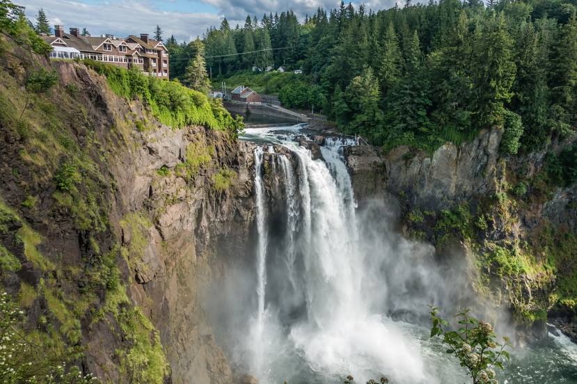
North Bend
Thorold
Saint Catharines
St. Catharines
Lincoln
Grimsby
International airport, hamilton
Hamilton
Hamilton Division
John C. Munro Hamilton International Airport
Brant
Brantford
Paris
Brant County
Burford
Woodstock
Ingersoll
Putnam
Belmont
Kilworth
Komoka
Falconbridge
Poplar Hill
Strathroy
Dejong
Watford
Lambton County
Point Edward
Port Huron
Allenton
Imlay City
Lapeer
Davison
Burton
Flint
Lennon
Morrice
Perry
East Lansing
DeWitt Township
Grand Ledge
Lowell
Grand Rapids
Comstock Park
Coopersville
Spring Lake
Muskegon
Milwaukee
Wauwatosa
Brookfield
Pewaukee
Hartland
Delafield
Oconomowoc
Concord
Johnson Creek
Lake Mills
Dane County Regional Airport
DeForest
Lodi
Wisconsin Dells
Mauston
New Lisbon
Camp Douglas
Tomah
Sparta
West Salem
Onalaska
Dakota
Stewartville
Brownsdale
Albert Lea
Blue Earth
Fairmont
Sherburn
Lakefield
Rushmore
Kanaranzi
Luverne
Renner
Sioux Falls Regional Airport
Crooks
Canistota
Mitchell
Plankinton
Pukwana
Chamberlain
Oacoma
Kennebec
Presho
Murdo
Kadoka
Wall
Rapid City
Summerset
Sturgis
Whitewood
Spearfish
Schloredt Airport
Moorcroft
Rozet
Gillette
Buffalo
Story
Banner
Sheridan
Ranchester
Parkman
Wyola
Lodge Grass
Garryowen
Crow Agency
Hardin
Lockwood
Billings
Reed Point
Greycliff
Big Timber
Livingston
Bozeman
Lux
Bozeman Yellowstone International Airport
Belgrade
Manhattan
Trident
Three Forks
Butte
Butte
Deer Lodge
Jens
Drummond Airport
Bonner-West Riverside
Missoula
Schilling
Alberton
Saint Regis
Saltese
Mullan
Wallace
Osburn
Kellogg
Cataldo
Coeur d'Alene
Post Falls
Liberty Lake
Spokane
Airway Heights
Cheney
Ritzville
Barham
Tiflis
Moses Lake
George
Kittitas
Ellensburg
Cle Elum
North Bend
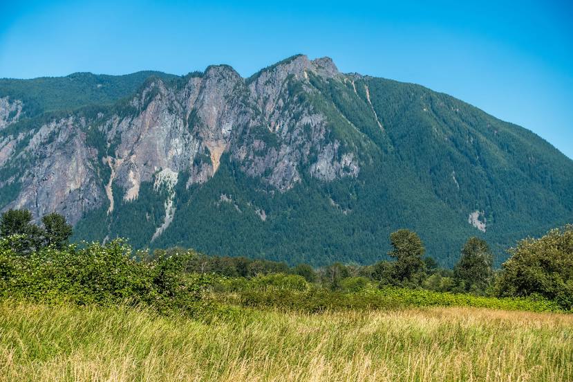
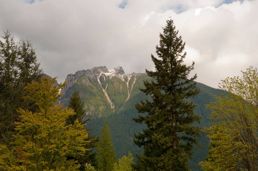
Amsterdam — Snoqualmie distance, route on the map
Distance by car
Distance between Amsterdam, New York, United States and Snoqualmie, Washington, United States by car is — km, or miles. To travel this distance by car, you need minute, or h.
Route on the map, driving directions
Car route Amsterdam — Snoqualmie was created automatically. The road on the map is shown as a blue line. By moving the markers, you can create a new route through the points you need.
Passing cities through which the car route passes: Amsterdam Airfield, Fultonville, Palatine Bridge, Herkimer, Mohawk, Ilion, Utica, Whitesboro, Oriskany, Verona, Oneida, Canastota, Chittenango, Fayetteville, East Syracuse, North Syracuse, Syracuse, Liverpool, Van Buren, Elbridge, Weedsport, Seneca Falls, Oaks Corners, Newark, Shortsville, Pittsford, Rochester, Mumford, Riga, Le Roy, South Byron, Elba, Clarence, Bowmansville, Williamsville, Amherst, Buffalo, Tonawanda, Kenmore, Niagara Falls, Queenston (ca), Thorold (ca), Saint Catharines (ca), St. Catharines (ca), Lincoln (ca), Grimsby (ca), International airport, hamilton (ca), Hamilton (ca), Hamilton Division (ca), John C. Munro Hamilton International Airport (ca), Brant (ca), Brantford (ca), Paris (ca), Brant County (ca), Burford (ca), Woodstock (ca), Ingersoll (ca), Putnam (ca), Belmont (ca), Kilworth (ca), Komoka (ca), Falconbridge (ca), Poplar Hill (ca), Strathroy (ca), Dejong (ca), Watford (ca), Lambton County (ca), Point Edward (ca), Port Huron, Allenton, Imlay City, Lapeer, Davison, Burton, Flint, Lennon, Morrice, Perry, East Lansing, DeWitt Township, Grand Ledge, Lowell, Grand Rapids, Comstock Park, Coopersville, Spring Lake, Muskegon, Milwaukee, Wauwatosa, Brookfield, Pewaukee, Hartland, Delafield, Oconomowoc, Concord, Johnson Creek, Lake Mills, Dane County Regional Airport, DeForest, Lodi, Wisconsin Dells, Mauston, New Lisbon, Camp Douglas, Tomah, Sparta, West Salem, Onalaska, Dakota, Stewartville, Brownsdale, Albert Lea, Blue Earth, Fairmont, Sherburn, Lakefield, Rushmore, Kanaranzi, Luverne, Renner, Sioux Falls Regional Airport, Crooks, Canistota, Mitchell, Plankinton, Pukwana, Chamberlain, Oacoma, Kennebec, Presho, Murdo, Kadoka, Wall, Rapid City, Summerset, Sturgis, Whitewood, Spearfish, Schloredt Airport, Moorcroft, Rozet, Gillette, Buffalo, Story, Banner, Sheridan, Ranchester, Parkman, Wyola, Lodge Grass, Garryowen, Crow Agency, Hardin, Lockwood, Billings, Reed Point, Greycliff, Big Timber, Livingston, Bozeman, Lux, Bozeman Yellowstone International Airport, Belgrade, Manhattan, Trident, Three Forks, Butte, Butte, Deer Lodge, Jens, Drummond Airport, Bonner-West Riverside, Missoula, Schilling, Alberton, Saint Regis, Saltese, Mullan, Wallace, Osburn, Kellogg, Cataldo, Coeur d'Alene, Post Falls, Liberty Lake, Spokane, Airway Heights, Cheney, Ritzville, Barham, Tiflis, Moses Lake, George, Kittitas, Ellensburg, Cle Elum, North Bend.
Distance by plane
If you decide to take a trip Amsterdam Snoqualmie by plane, then you have to fly the distance — 3707 km or 2298 miles. It is marked on the map with a gray line (between two points in a straight line).
Flight time
Estimated flight time Amsterdam Snoqualmie by plane at cruising speed 750 km / h will be — 4 h. and 56 min.
Direction of movement
United States, Amsterdam — right-hand traffic. United States, Snoqualmie — right-hand traffic.
Difference in time
Amsterdam and Snoqualmie are in different time zones. The time difference is 3 hours (UTC -4 America/New_York, UTC -7 America/Los_Angeles).
Interesting Facts
Information on alternative ways to get to your destination.
The length of this distance is about 9.3% of the total length of the equator.
The percentage of the population is clearly shown in the graph:
Amsterdam — 17,735, Snoqualmie — 10,670 residents (less by 7,065).
The cost of travel
Calculate the cost of the trip yourself using the fuel consumption calculator, changing the data in the table.