Gallup — Newcomerstown
Gallup — Hamlin
Gallup — Merna
Gallup — Ikes Fork
Gallup — Tahlequah
Gallup — South Wellfleet
Gallup — Tombstone
Gallup — Corsica
Gallup — Betsy Layne
Gallup — Orlando
Gallup — Honeoye
Gallup — Renick
Gallup — Sorento
Gallup — Groveland
Gallup — Orangeville
Gallup — Donaldson
Gallup — Kilauea
Gallup — Fort Blackmore
Gallup — Sequatchie County
Mentmore
Lupton
Houck
Sanders
Chambers
Holbrook
Winslow
Flagstaff
Bellemont
Williams
Ash Fork
Seligman
Kingman
Yucca
Topock
Needles
Newberry Springs
Minneola
Daggett
Barstow
Hutt
Oro Grande
Victorville
Hesperia
Cajon Junction
Lytle Creek
Fontana
Rancho Cucamonga
Upland
Upland
Claremont
San Dimas
Glendora
Citrus
Azusa
Duarte
Baldwin Park
El Monte
Avocado Heights
South El Monte
Whittier
Pico Rivera
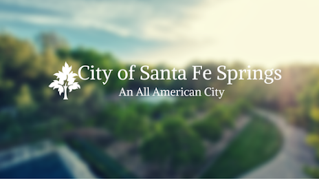
Gallup — Santa Fe Springs distance, route on the map
Distance by car
Distance between Gallup, New Mexico, United States and Santa Fe Springs, California, United States by car is — km, or miles. To travel this distance by car, you need minute, or h.
Route on the map, driving directions
Car route Gallup — Santa Fe Springs was created automatically. The road on the map is shown as a blue line. By moving the markers, you can create a new route through the points you need.
Passing cities through which the car route passes: Gallup, Mentmore, Lupton, Houck, Sanders, Chambers, Holbrook, Winslow, Flagstaff, Bellemont, Williams, Ash Fork, Seligman, Kingman, Yucca, Topock, Needles, Newberry Springs, Minneola, Daggett, Barstow, Hutt, Oro Grande, Victorville, Hesperia, Cajon Junction, Lytle Creek, Fontana, Rancho Cucamonga, Upland, Upland, Claremont, San Dimas, Glendora, Citrus, Azusa, Duarte, Baldwin Park, El Monte, Avocado Heights, South El Monte, Whittier, Pico Rivera.
Distance by plane
If you decide to take a trip Gallup Santa Fe Springs by plane, then you have to fly the distance — 871 km or 540 miles. It is marked on the map with a gray line (between two points in a straight line).
Flight time
Estimated flight time Gallup Santa Fe Springs by plane at cruising speed 750 km / h will be — 1 h. and 9 min.
Direction of movement
United States, Gallup — right-hand traffic. United States, Santa Fe Springs — right-hand traffic.
Difference in time
Gallup and Santa Fe Springs are in different time zones. The time difference is 1 hour (UTC -6 America/Denver, UTC -7 America/Los_Angeles).
Interesting Facts
Information on alternative ways to get to your destination.
The length of this distance is about 2.2% of the total length of the equator.
The percentage of the population is clearly shown in the graph:
Gallup — 19,454, Santa Fe Springs — 16,330 residents (less by 3,124).
The cost of travel
Calculate the cost of the trip yourself using the fuel consumption calculator, changing the data in the table.