Fergus Falls — Bountiful
Fergus Falls — Highlandville
Fergus Falls — Vallejo
Fergus Falls — Oran
Fergus Falls — Hahira
Fergus Falls — Fairview Heights
Fergus Falls — Goshen
Fergus Falls — Warfield
Fergus Falls — Garnavillo
Fergus Falls — Anza
Fergus Falls — San Francisco County
Fergus Falls — Tynan
Fergus Falls — Skaneateles Falls
Fergus Falls — Lockhart
Fergus Falls — Acadia Parish
Fergus Falls — Mount Cory
Fergus Falls — Danville
Fergus Falls — Hampton
Fergus Falls — Delft
Alexandria
Sauk Centre
Meire Grove
Waite Park
Saint Cloud
Becker
Big Lake
Albertville
Saint Michael
Osseo
Maple Grove
Plymouth
Minnetonka
Eden Prairie
Bloomington
Burnsville
Lakeville
Dundas
Faribault
Rice County
Fergus Falls — Owatonna distance, route on the map
Distance by car
Distance between Fergus Falls, Minnesota, United States and Owatonna, Minnesota, United States by car is — km, or miles. To travel this distance by car, you need minute, or h.
Route on the map, driving directions
Car route Fergus Falls — Owatonna was created automatically. The road on the map is shown as a blue line. By moving the markers, you can create a new route through the points you need.
Passing cities through which the car route passes: Melby, Alexandria, Sauk Centre, Meire Grove, Waite Park, Saint Cloud, Becker, Big Lake, Albertville, Saint Michael, Osseo, Maple Grove, Plymouth, Minnetonka, Eden Prairie, Bloomington, Burnsville, Lakeville, Dundas, Faribault, Rice County.
Distance by plane
If you decide to take a trip Fergus Falls Owatonna by plane, then you have to fly the distance — 331 km or 205 miles. It is marked on the map with a gray line (between two points in a straight line).
Flight time
Estimated flight time Fergus Falls Owatonna by plane at cruising speed 750 km / h will be — 26 min.
Direction of movement
United States, Fergus Falls — right-hand traffic. United States, Owatonna — right-hand traffic.
Difference in time
Fergus Falls and Owatonna are in the same time zone. Between them there is no time difference (UTC -5 America/Chicago).
Interesting Facts
Information on alternative ways to get to your destination.
The length of this distance is about 0.8% of the total length of the equator.
The percentage of the population is clearly shown in the graph:
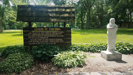
Fergus Falls — 14,364 (less by 9,591), Owatonna — 23,955 residents.
The cost of travel
Calculate the cost of the trip yourself using the fuel consumption calculator, changing the data in the table.