Kent — Monmouth County
Kent — Ladoga
Kent — Redby
Kent — Devils Tower
Kent — Ruffs Dale
Kent — Manlius
Kent — Haydenville
Kent — Etna
Kent — Ethel
Kent — Borden
Kent — Cass County
Kent — Ridgeview
Kent — Webster
Kent — Ruby Airport
Kent — Berkeley
Kent — Conde
Kent — Kelseyville
Kent — Flora
Kent — Mayview
Snoqualmie
North Bend
Cle Elum
Ellensburg
Pomona
Selah
Yakima
Moxee
Wapato
Toppenish
Zillah
Granger
Outlook
Sunnyside
Prosser
Irrigon
Umatilla
Hermiston
Stanfield
Eastern Oregon Regional Airport at Pendleton
Pendleton
Meacham
La Grande
North Powder
Baker City
Baker County
Payette
Ontario
Fruitland
New Plymouth
Canyon County
Caldwell
Nampa
Meridian
Boise
Boise
Mountain Home
Hammett
Glenns Ferry
Bliss
Hagerman
Kimberly
Hazelton
Burley
Travers
Snowville
Tremonton
Tremonton Municipal Airport
Honeyville
Corinne
Brigham City
Ogden
Washington Terrace
Riverdale
Morgan County
Henefer
Coalville
Fort Bridger
Lyman
Rock Springs
Rawlins
Sinclair
Elk Mountain
Laramie
Cheyenne
Carr
Fort Collins
Timnath
Loveland
Mead
Rancho De Aereo Airport
Dacono
Thornton
North Washington
Denver
Glendale
Cherry Hills Village
Greenwood Village
Castlewood
Centennial
Lone Tree
Castle Rock
Douglas County
Palmer Lake
Monument
Kent — Monmouth County
Kent — Ladoga
Kent — Redby
Kent — Devils Tower
Kent — Ruffs Dale
Kent — Manlius
Kent — Haydenville
Kent — Etna
Kent — Ethel
Kent — Borden
Kent — Cass County
Kent — Ridgeview
Kent — Webster
Kent — Ruby Airport
Kent — Berkeley
Kent — Conde
Kent — Kelseyville
Kent — Flora
Kent — Mayview
Snoqualmie
North Bend
Cle Elum
Ellensburg
Pomona
Selah
Yakima
Moxee
Wapato
Toppenish
Zillah
Granger
Outlook
Sunnyside
Prosser
Irrigon
Umatilla
Hermiston
Stanfield
Eastern Oregon Regional Airport at Pendleton
Pendleton
Meacham
La Grande
North Powder
Baker City
Baker County
Payette
Ontario
Fruitland
New Plymouth
Canyon County
Caldwell
Nampa
Meridian
Boise
Boise
Mountain Home
Hammett
Glenns Ferry
Bliss
Hagerman
Kimberly
Hazelton
Burley
Travers
Snowville
Tremonton
Tremonton Municipal Airport
Honeyville
Corinne
Brigham City
Ogden
Washington Terrace
Riverdale
Morgan County
Henefer
Coalville
Fort Bridger
Lyman
Rock Springs
Rawlins
Sinclair
Elk Mountain
Laramie
Cheyenne
Carr
Fort Collins
Timnath
Loveland
Mead
Rancho De Aereo Airport
Dacono
Thornton
North Washington
Denver
Glendale
Cherry Hills Village
Greenwood Village
Castlewood
Centennial
Lone Tree
Castle Rock
Douglas County
Palmer Lake
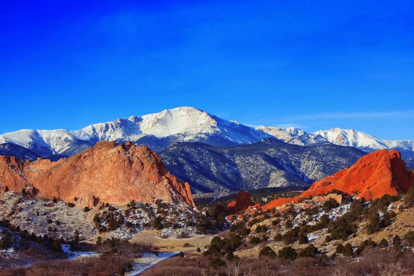
Monument
Kent — Colorado Springs distance, route on the map
Distance by car
Distance between Kent, Washington, United States and Colorado Springs, Colorado, United States by car is — km, or miles. To travel this distance by car, you need minute, or h.
Route on the map, driving directions
Car route Kent — Colorado Springs was created automatically. The road on the map is shown as a blue line. By moving the markers, you can create a new route through the points you need.
Passing cities through which the car route passes: Maple Valley, Snoqualmie, North Bend, Cle Elum, Ellensburg, Pomona, Selah, Yakima, Moxee, Wapato, Toppenish, Zillah, Granger, Outlook, Sunnyside, Prosser, Irrigon, Umatilla, Hermiston, Stanfield, Eastern Oregon Regional Airport at Pendleton, Pendleton, Meacham, La Grande, North Powder, Baker City, Baker County, Payette, Ontario, Fruitland, New Plymouth, Canyon County, Caldwell, Nampa, Meridian, Boise, Boise, Mountain Home, Hammett, Glenns Ferry, Bliss, Hagerman, Kimberly, Hazelton, Burley, Travers, Snowville, Tremonton, Tremonton Municipal Airport, Honeyville, Corinne, Brigham City, Ogden, Washington Terrace, Riverdale, Morgan County, Henefer, Coalville, Fort Bridger, Lyman, Rock Springs, Rawlins, Sinclair, Elk Mountain, Laramie, Cheyenne, Carr, Fort Collins, Timnath, Loveland, Mead, Rancho De Aereo Airport, Dacono, Thornton, North Washington, Denver, Glendale, Cherry Hills Village, Greenwood Village, Castlewood, Centennial, Lone Tree, Castle Rock, Douglas County, Palmer Lake, Monument.
Distance by plane
If you decide to take a trip Kent Colorado Springs by plane, then you have to fly the distance — 1698 km or 1053 miles. It is marked on the map with a gray line (between two points in a straight line).
Flight time
Estimated flight time Kent Colorado Springs by plane at cruising speed 750 km / h will be — 2 h. and 15 min.
Direction of movement
United States, Kent — right-hand traffic. United States, Colorado Springs — right-hand traffic.
Difference in time
Kent and Colorado Springs are in different time zones. The time difference is 1 hour (UTC -7 America/Los_Angeles, UTC -6 America/Denver).
Interesting Facts
Information on alternative ways to get to your destination.
The length of this distance is about 4.2% of the total length of the equator.
The percentage of the population is clearly shown in the graph:
Kent — 92,411 (less by 280,661), Colorado Springs — 373,072 residents.
The cost of travel
Calculate the cost of the trip yourself using the fuel consumption calculator, changing the data in the table.